
Rockhounding in Custer County, South Dakota
13 mapped rockhounding spots in Custer County. Most commonly produces fairburn agate, agate, almandine garnet, banded agate.
Every rockhounding spot in Custer County
 Best spotTepee CanyonCuster County, South DakotaPublic access · Agate, Beryl, Almandine Garnet +3
- Best spotFairburnCuster County, South DakotaPublic access · Fairburn Agate, Agatized Wood, Yellow Jasper
- Best spotCheyenne RiverCuster County, South DakotaPublic access · Fairburn Agate
 Tin MountainCuster County, South DakotaCheck locally · Fluorapatite, Quartz, Almandine Garnet +4
 Hell CanyonCuster County, South DakotaPublic access · Banded Agate, Jade, Jasper +2
- Pleasant Valley CreekCuster County, South DakotaPublic access · Banded Agate, Jade, Jasper +2
- French Creek Agate BedsCuster County, South DakotaPublic access · Fairburn Agate, Agate, Rose Quartz +1
- Laughing Water CreekCuster County, South DakotaPublic access · Columbite, Gold, Silver
- November MineCuster County, South DakotaPermission required · Arsenopyrite, Fluorapatite
- Buffalo GapCuster County, South DakotaPublic access · Fairfield Agate
- FairburnCuster County, South DakotaPermission required · Fairburn Agate
- PringleCuster County, South DakotaPublic access · Fairhill Agate
- Teepee Canyon AgatesCuster County, South DakotaPublic access · Agate
Custer County rockhounding photos
Representative spot and material photos from this county, shown where verified public image records are available.
Minerals reported in Custer County
Standouts in Custer County
Hand-picked spots in Custer County, chosen for unusual mineralogy or documented public access. Each card opens the full coordinates and access notes.
 Top pick
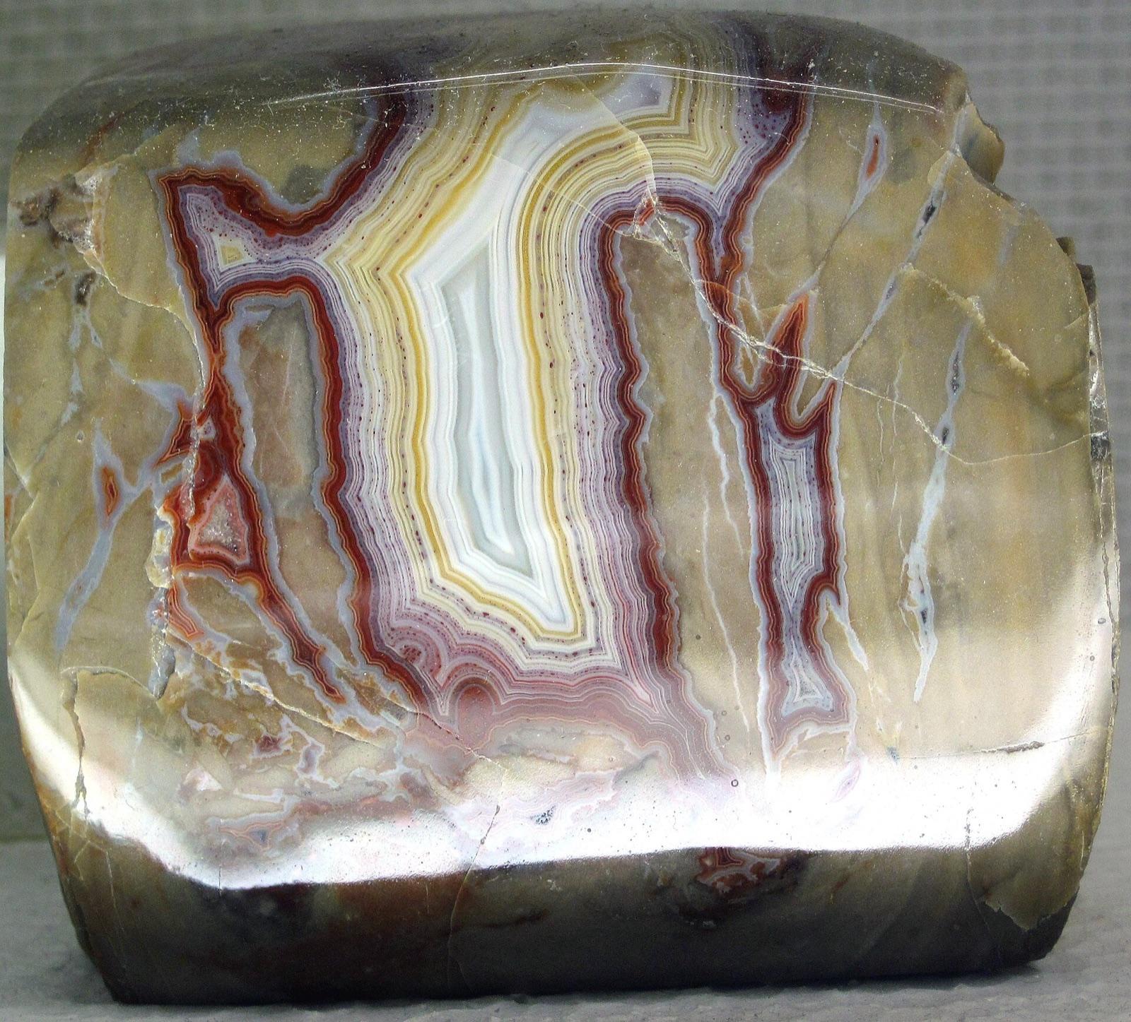
Tepee Canyon
Public accessCuster County
Tepee Canyon is the home of the distinctive Tepee Canyon banded agate, a fortification agate of purples, reds, and oranges encased in a chocolate-brown limestone host.
Agate, Beryl, Almandine Garnet, Lepidolite
 Top pick
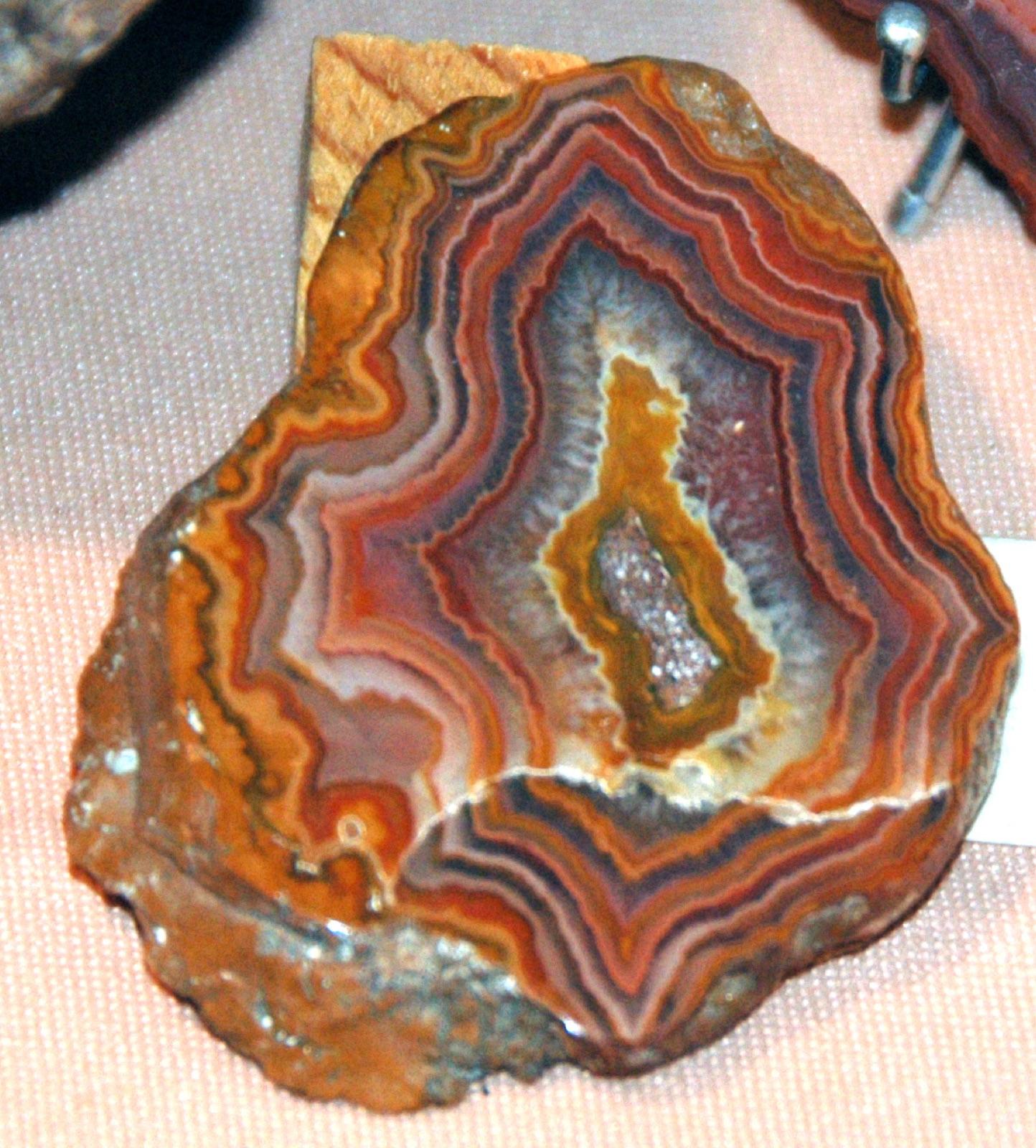
Fairburn
Public accessCuster County
These are the classic Fairburn agate beds, the type locality for South Dakota's official state gem, sitting in the eroded badlands and surface gravels just east of the village of Fairburn.
Fairburn Agate, Agatized Wood, Yellow Jasper
 Top pick
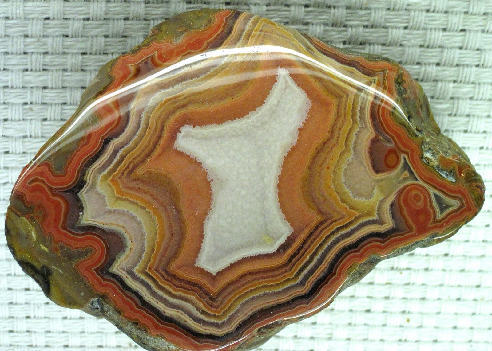
Cheyenne River
Public accessCuster County
This locality along the Cheyenne River drainage sits within the core Fairburn agate belt just south of the main Fairburn beds, and the river gravels and surrounding badlands carry the same prized state-gem fortification agate.
Fairburn Agate
Neighboring counties in South Dakota
Adjacent rockhounding counties, ranked by how close their centroids sit to Custer County. A natural extension if Custer County is already on your trip plan.
- Pennington County~30 mi8 spotsTop: Agate, Aquamarine, Beryl
- Fall River County~34 mi3 spotsTop: Agatized Wood, Fairburn Agate, Jasper
- Oglala Lakota County~40 mi4 spotsTop: Agate, Chalcedony, Jasper
- Lawrence County~52 mi4 spotsTop: Amethyst, Chalcedony, Geode
- Meade County~56 mi5 spotsTop: Amber Barite, Barite, Calcite
- Harding County~132 mi1 spotTop: Chalcedony, Moss Agate
Across the state line from Custer County
Rockhounding counties in neighboring states within driving range. Geology rarely respects state borders. These are often the closest mapped spots you can reach without going deeper into South Dakota.
Custer County FAQ
Where can I rockhound in Custer County, South Dakota?+
What rocks and minerals are common in Custer County?+
Are these Custer County rockhounding spots on public land?+
Plan a Custer County rockhounding trip
Open RockHoundR to see these spots on the map alongside land overlays, weather, geology, and your saved finds.

