
Eastern Washington (Saddle Mountain, Beverly)
Petrified wood including Ginkgo wood (outside the state park), agate, and jasper in the Columbia Basin. Hot and dry in summer.
Updated October 2026
100 mapped spots for rock hunting and rock collecting across 30 counties. Washington has good public access for agate, petrified wood, quartz crystals, geodes, and fossils. Saddle Mountain, Walker Valley, Hansen Creek, and the Stonerose fossil site at Republic are the names most rockhounds start with.
The best rockhounding in Washington is at Crescent Beach in Clallam County (agate, chert), Red Top Mt. and Teanaway Ridge in Kittitas County (blue agate geode), and Liberty in Kittitas County (gold). In total, 100 mapped collecting spots across 30 counties produce agate, gold, and jasper, each listed below with its land access.
 Best spotPe EllLewis County, WashingtonPublic access · Agate, Carnelian, Chalcedony +3Best spotTunk CreekOkanogan County, WashingtonPublic access · Quartz, Blue Corundum, Pink Corundum +2Best spotCrescent BeachClallam County, WashingtonPublic access · Agate, Chert, JasperBest spotColumbia RiverKittitas County, WashingtonPublic access · Opalized Wood, Petrified WoodBest spotMoclipsGrays Harbor County, WashingtonPublic access · Agate, Jasper
 Best spotWashougalClark County, WashingtonPermission required · Moss Agate, AmethystBest spotLibertyKittitas County, WashingtonPublic access · GoldBest spotRed Top Mt. and Teanaway RidgeKittitas County, WashingtonPublic access · Blue Agate GeodeBest spotRingoldFranklin County, WashingtonPublic access · AgateBest spotWillapa HillsPacific County, WashingtonPublic access · Agatized Fossil Shell
 Monte CristoSnohomish County, WashingtonPublic access · Arsenic, Arsenopyrite, Azurite +7
 CentraliaLewis County, WashingtonPermission required · Agate, Carnelian, Chalcedony +3DotyLewis County, WashingtonPermission required · Agate, Carnelian, Chalcedony +3Lucas CreekLewis County, WashingtonPublic access · Agate, Carnelian, Chalcedony +3Denny Mt.King County, WashingtonPermission required · Calcite, Quartz, Amethyst +2Mt. AdamsSkamania County, WashingtonPermission required · Agate, Carnelian, Chalcedony +2BickletonKlickitat County, WashingtonPermission required · Agate, Carnelian, Jasper +1Green CreekPacific County, WashingtonPublic access · Agate, Carnelian, Chalcedony +1Long BeachPacific County, WashingtonPublic access · Agate, Chalcedony, QuartzOcean ParkPacific County, WashingtonPublic access · Agate, Chalcedony, QuartzQueetsJefferson County, WashingtonPermission required · Agate, Chert, JasperShi Shi BeachClallam County, WashingtonPublic access · Gold, Iridosmine, PlatinumSol Duc RiverClallam County, WashingtonPublic access · Agate, Chert, JasperWalker ValleySkagit County, WashingtonPublic access · Geode, Agate, Blue AgateCairn Hope PeakYakima County, WashingtonPermission required · Petrified Wood, Opalized WoodChattaroySpokane County, WashingtonPublic access · Garnet, QuartzCherry PointWhatcom County, WashingtonPublic access · Agate, JasperDungenessClallam County, WashingtonPublic access · Agate, Orbicular JasperHamiltonSkagit County, WashingtonPublic access · Hematite, GoldHorseshoe Basin districtChelan County, WashingtonPermission required · Chalcopyrite, GalenaKalalochJefferson County, WashingtonPermission required · Agate, JasperLa PushClallam County, WashingtonPermission required · Agate, JasperLake Merwin Area CarneliansCowlitz County, WashingtonPublic access · Agate, CarnelianLebamPacific County, WashingtonPublic access · Agatized Fossil Shell, ChalcedonyLibertyKittitas County, WashingtonPublic access · Agate, Chalcedony NoduleLyman LakeOkanogan County, WashingtonPublic access · Gold, QuartzMabtonYakima County, WashingtonPublic access · Petrified Wood, Opalized WoodMcCoy Farm near AdnaLewis County, WashingtonPublic access · Carnelian, Petrified WoodMethowOkanogan County, WashingtonPublic access · Stibnite, ChalcopyriteMiddle Fork Teanaway RiverKittitas County, WashingtonPublic access · Agate, Chalcedony GeodeMondoviLincoln County, WashingtonPublic access · Opal, Fire OpalNewaukum River gravelsLewis County, WashingtonPublic access · Geode, NoduleOsoyoos LakeOkanogan County, WashingtonPublic access · Copper, PyritePasayten WildernessWhatcom County, WashingtonPublic access · Gold, PyritePetrified Forest State ParkKittitas County, WashingtonPublic access · Opalized Wood, Petrified WoodPoint RobertsWhatcom County, WashingtonPublic access · Agate, JasperRattlesnake Mt.Benton County, WashingtonPublic access · Petrified Wood, Opalized WoodSapphoClallam County, WashingtonPublic access · Agate, Orbicular JasperToledoLewis County, WashingtonPublic access · Geode, NoduleAberdeenGrays Harbor County, WashingtonPublic access · Flower JasperAmerican RiverYakima County, WashingtonPublic access · GoldBald ButteWhitman County, WashingtonPublic access · Smoky QuartzBridgeportDouglas County, WashingtonPublic access · JadeiteBrush PrairieClark County, WashingtonPublic access · GoldCamasClark County, WashingtonPublic access · GoldCathedral PeakOkanogan County, WashingtonPermission required · WolframiteClarkstonAsotin County, WashingtonPublic access · GoldClay CityPierce County, WashingtonPublic access · AmethystCle ElumKittitas County, WashingtonPublic access · Blue AgateColumbia RiverChelan County, WashingtonPublic access · GoldCopper King MineStevens County, WashingtonPublic access · ChalcopyriteCovadaFerry County, WashingtonPermission required · StibniteDamon PointGrays Harbor County, WashingtonPublic access · AgateDarringtonSnohomish County, WashingtonPublic access · GoldDaybreak MineSpokane County, WashingtonPublic access · AutuniteDeer CreekSkagit County, WashingtonPublic access · Nephrite JadeDeer LakeStevens County, WashingtonPublic access · PyriteEllensburgKittitas County, WashingtonPublic access · GeodeGold BarSnohomish County, WashingtonPublic access · GoldGold CreekFerry County, WashingtonPermission required · GoldGrand CouleeGrant County, WashingtonPublic access · Opalized WoodGranite FallsSnohomish County, WashingtonPublic access · GoldHorse Heaven HillsBenton County, WashingtonPublic access · Opalized WoodIssaquahKing County, WashingtonPublic access · AmberKelsoCowlitz County, WashingtonPublic access · AgateKlickitat RiverKlickitat County, WashingtonPublic access · Petrified WoodLake CrescentClallam County, WashingtonPermission required · JasperLyleKlickitat County, WashingtonPublic access · Petrified WoodMarcusStevens County, WashingtonPermission required · GoldMary Ann CreekOkanogan County, WashingtonPublic access · GoldMattawaGrant County, WashingtonPublic access · Opalized WoodMetaline FallsPend Oreille County, WashingtonPublic access · SmithsoniteMoney CreekKing County, WashingtonPublic access · GoldMoses CouleeDouglas County, WashingtonPublic access · Opalized WoodNespelem to Coulee DamDouglas County, WashingtonPermission required · GoldNewportPend Oreille County, WashingtonPublic access · AmethystOyster Dome RoadcutSkagit County, WashingtonPublic access · StilpnomelaneOzette RiverClallam County, WashingtonPermission required · GoldPullmanWhitman County, WashingtonPublic access · Fire OpalSacheen LakePend Oreille County, WashingtonPublic access · GarnetSilver HillSpokane County, WashingtonPublic access · CassiteriteSnake RiverAsotin County, WashingtonPublic access · Fire OpalSnake RiverAsotin County, WashingtonPublic access · GoldSnake RiverGarfield County, WashingtonPublic access · GoldSultanSnohomish County, WashingtonPublic access · GoldThunder Creek DistrictSkagit County, WashingtonPermission required · SilverWatervilleDouglas County, WashingtonPublic access · Common OpalWhitehorse TrailSnohomish County, WashingtonPublic access · Nephrite JadeHansen Creek Opal MineKing County, WashingtonFee digSpokane, WashingtonSpokane County, WashingtonPublic access
Representative spot and material photos from locations in this state, shown where verified public image records are available.
Counts reflect how many spots in this list mention each mineral.
Notable areas: Walker Valley geodes, Hansen Creek quartz and amethyst, Saddle Mountain petrified wood, and Stonerose Eocene fossils are common Washington targets.
Eastern Washington is largely covered by Miocene Columbia River Basalts, which buried and silicified forests now collected as Saddle Mountain and Beverly petrified wood. The Cascades expose altered volcanics with quartz pockets and geodes, including Hansen Creek and Walker Valley. In the northeast, the Republic lake beds at Stonerose produce Eocene plant and insect fossils.
Petrified wood including Ginkgo wood (outside the state park), agate, and jasper in the Columbia Basin. Hot and dry in summer.
Walker Valley geodes near Mount Vernon, Hansen Creek quartz and amethyst crystals near Snoqualmie. Wet and brushy, gloves and boots required.
Eocene plant and insect fossils at the Stonerose Interpretive Center. Pay an entry fee, get a permit, dig the lakebed shale, and keep up to three specimens per visit.
Beach agates, jasper, and fossil wood along the Pacific shoreline. Olympic National Park is closed to collecting; nearby state and tribal beaches have separate rules.
East side: April–October. West side: drier May–September. Stonerose: open May 1 through October 31, weather dependent.
Cascade locations need rain gear and waterproof boots much of the year. East-side desert spots need sun protection and water. Stonerose loans hammers but bring safety glasses and a hand lens.
Washington designated petrified wood as its state gem in 1975. Near Vantage, the Ginkgo Petrified Forest preserves trees buried by basalt flows about 15 million years ago.
Day-trip range. Each section lists the closest mapped rockhounding spots within about 150 miles of the city. Most are inside a 2 to 3 hour drive.
6 closest spots to Seattle, WA.
6 closest spots to Spokane, WA.
6 closest spots to Yakima, WA.
Geology rarely respects state borders. These states share mapped rockhounding country with Washington, useful when Washington is the start, not the whole trip. Each card links to the closest county across the line.
County pages are linked once we have at least 3 mapped spots for a focused guide with coordinates, mineral notes, and nearby spots.
Hand-picked standouts from the Washington list, chosen for unusual mineralogy, documented public access, or both. Each card links to coordinates, access notes, and what to look for.
 Top pick
Clallam County
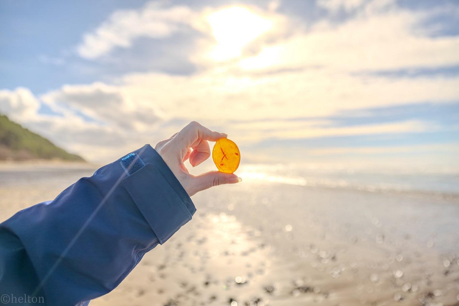
Agates were once plentiful enough at Agate Bay, just west of Crescent Bay on the Strait of Juan de Fuca, to give the beach its name, and agate still weathers from the local basalt alongside variously colored chert and jasper.
Agate, Chert, Jasper
 Top pick
Kittitas County
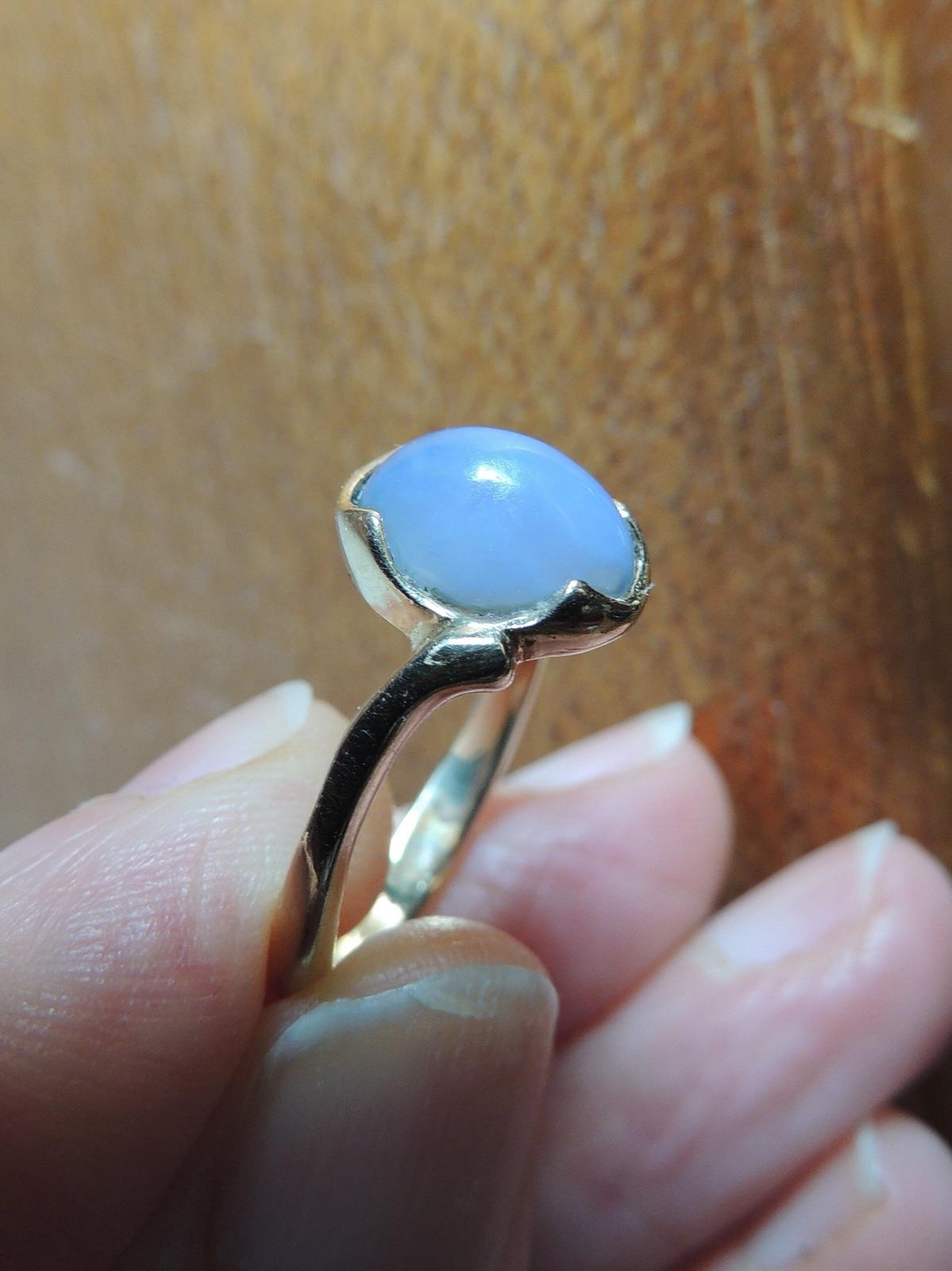
Red Top Mountain sits on the Eocene Teanaway Basalt, the rock unit Washington geologists identify as the source of the area's chalcedony, agate, and quartz-lined geodes.
Blue Agate Geode
 Top pick
Kittitas County
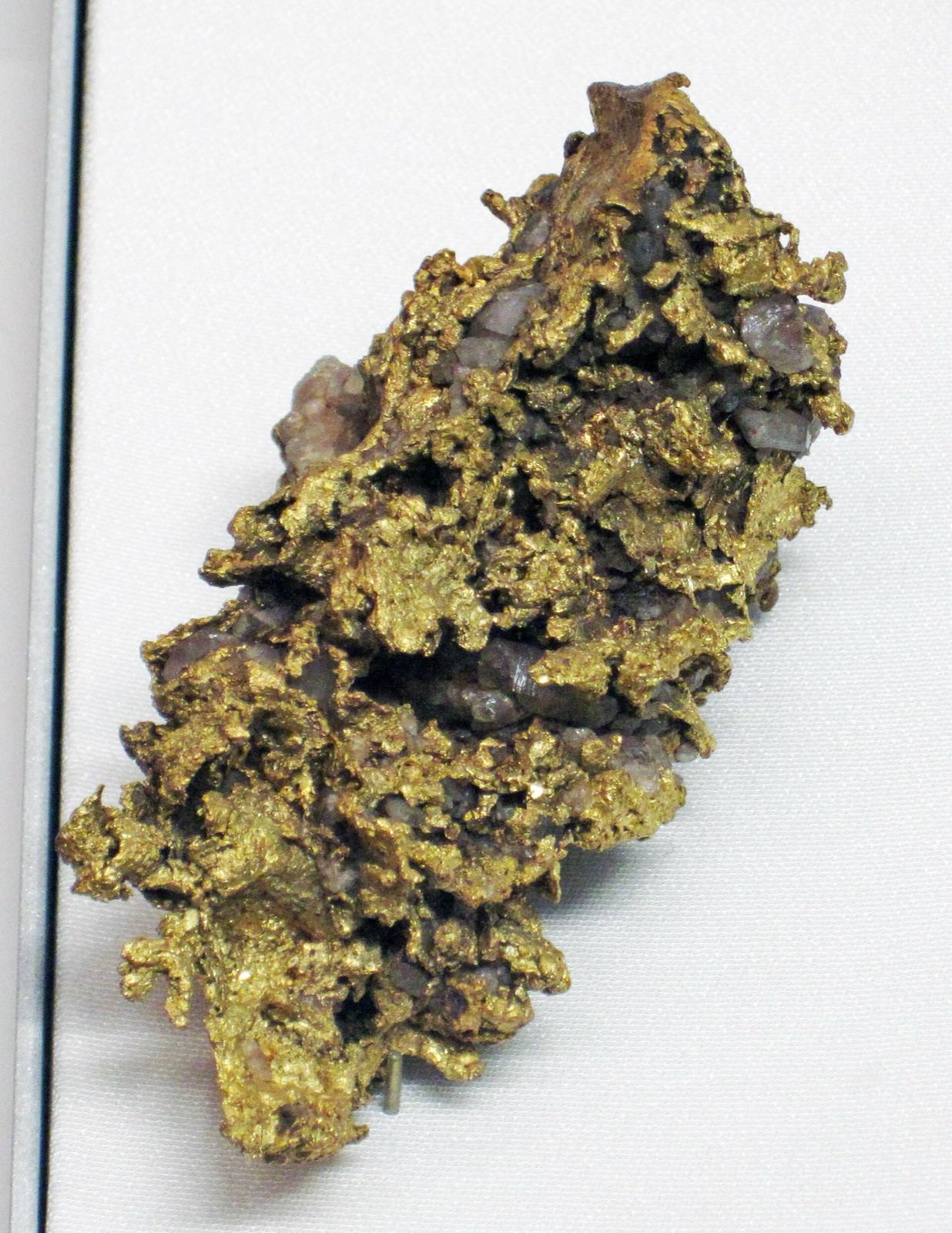
The Liberty and Swauk district produced some of the finest crystalline and wire gold specimens in the United States, formed in epithermal quartz veins above town and recovered as coarse nuggets in Swauk and Williams creeks.
Gold
 Top pick
Kittitas County
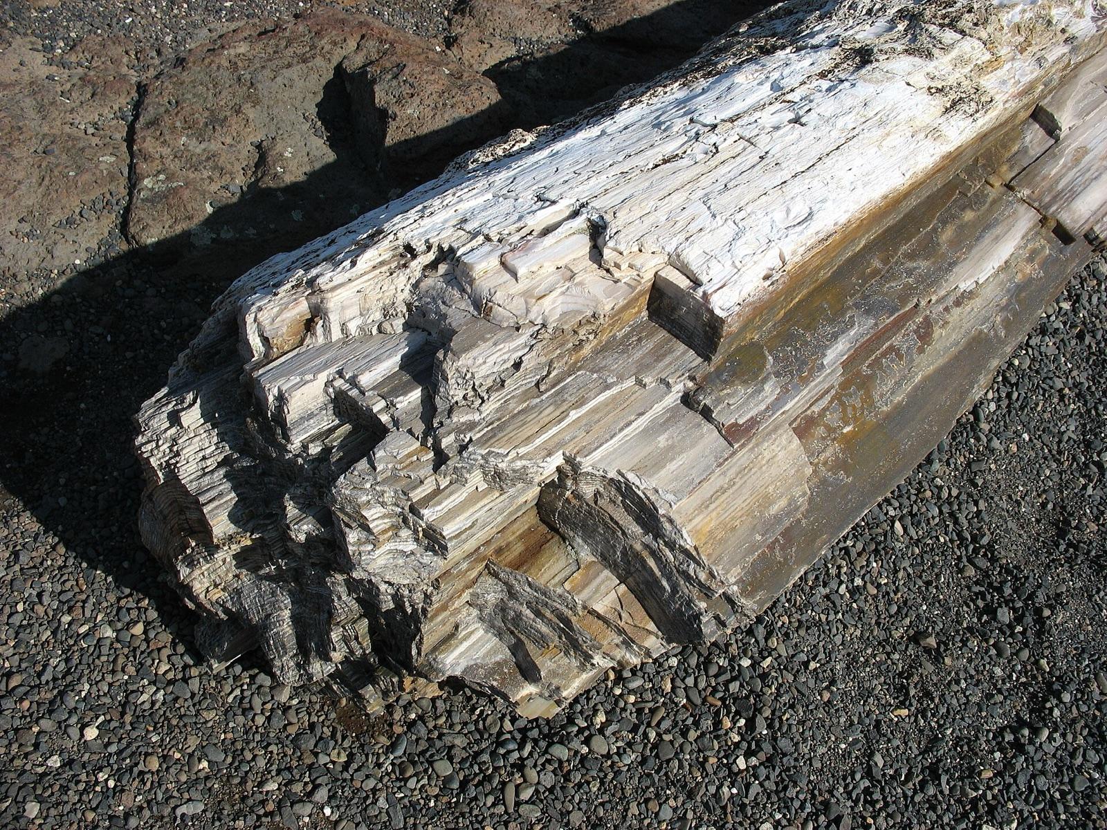
The Saddle Mountains expose a petrified forest preserved between Wanapum Basalt flows roughly 14 to 15 million years old, and the area is one of the few places where collectors can legally gather Washington's state gem on public land.
Opalized Wood, Petrified Wood
 Top pick
Okanogan County
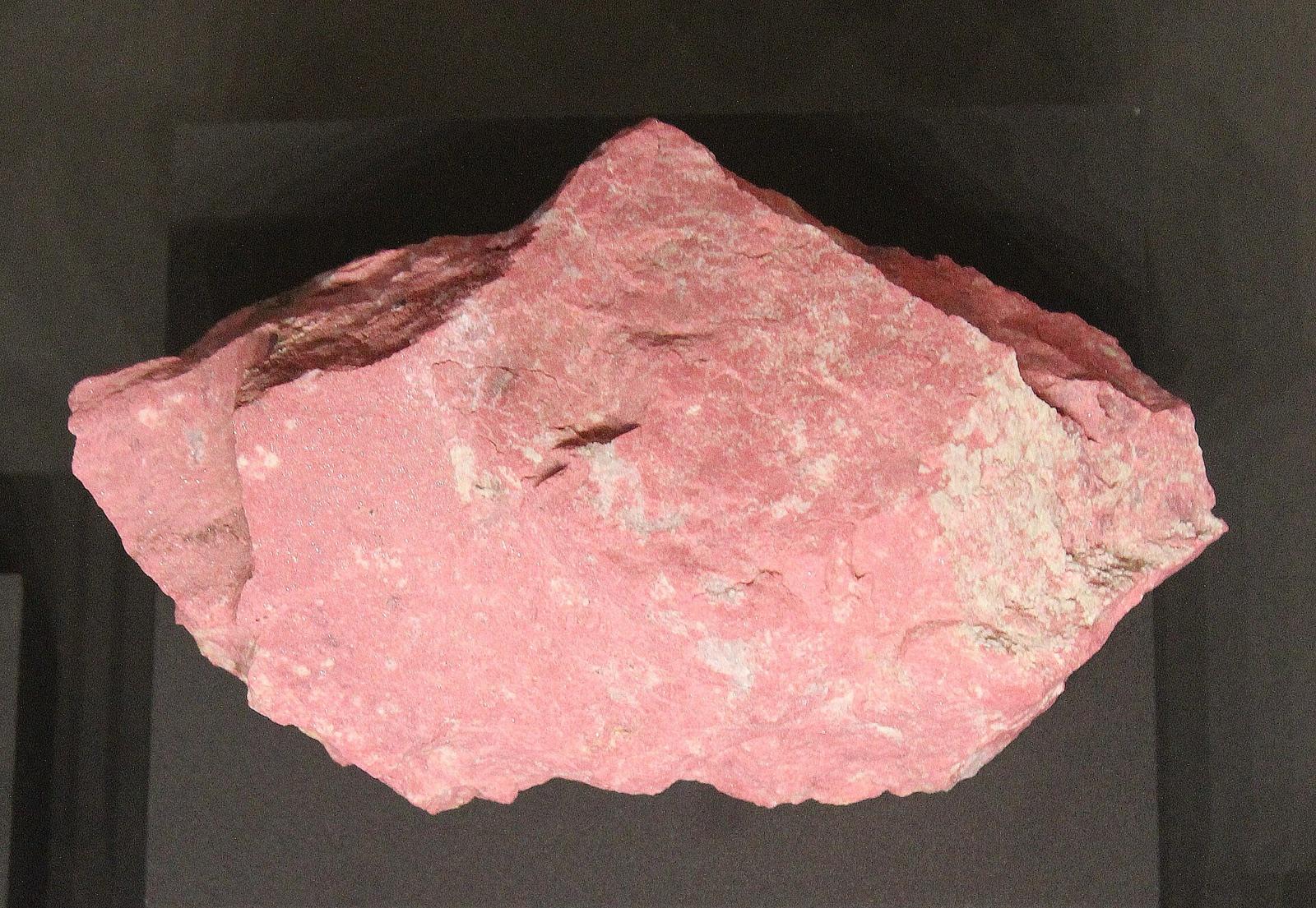
Tunk Creek is one of Washington's few documented thulite localities, where rose-pink thulite, a variety of zoisite, occurs in lenses up to three feet across within hornblende schist.
Quartz, Blue Corundum, Pink Corundum, Thulite
 Top pick
Franklin County
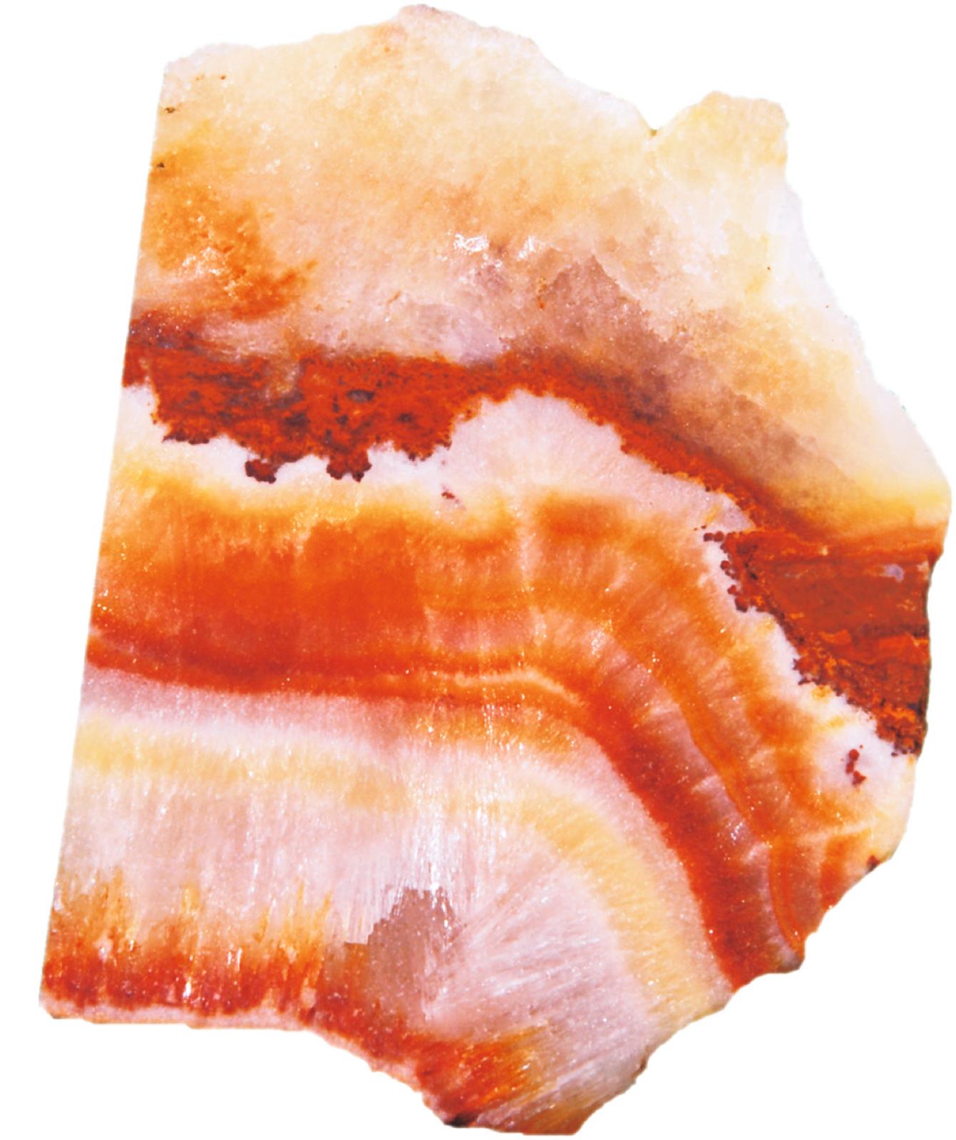
Iron-stained gravels at the base of the White Bluffs, on the east side of the Columbia River from Byers Landing to Ringold, hold frequent agate and jasper, the agate chiefly gray and buff chalcedony with some red hues.
Agate
 Top pick
Clark County
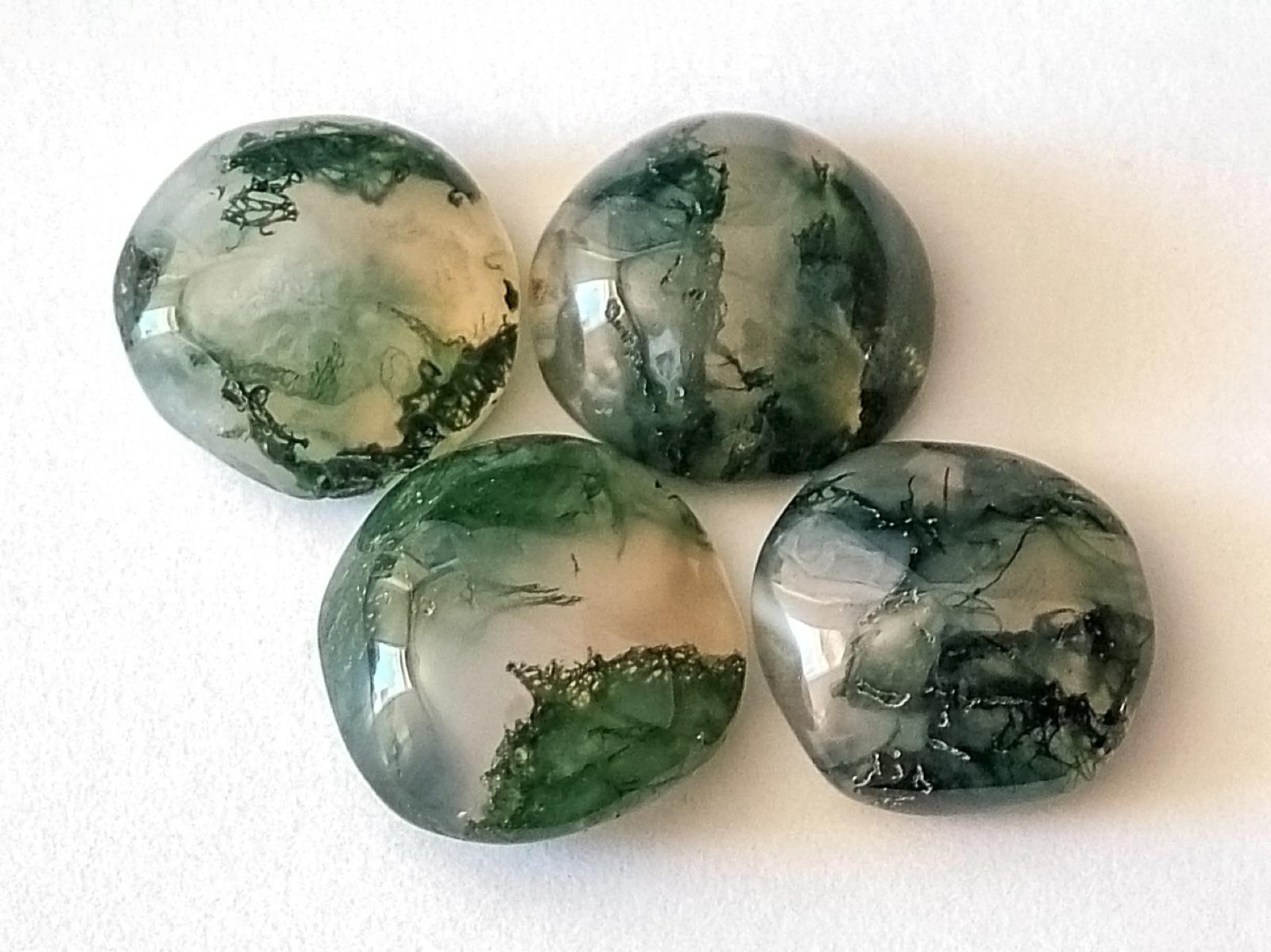
Gravel bars along the Washougal River yield moss agate, carnelian, jasper, and petrified wood weathered from the surrounding volcanic terrain.
Moss Agate, Amethyst
 Top pick
Grays Harbor County
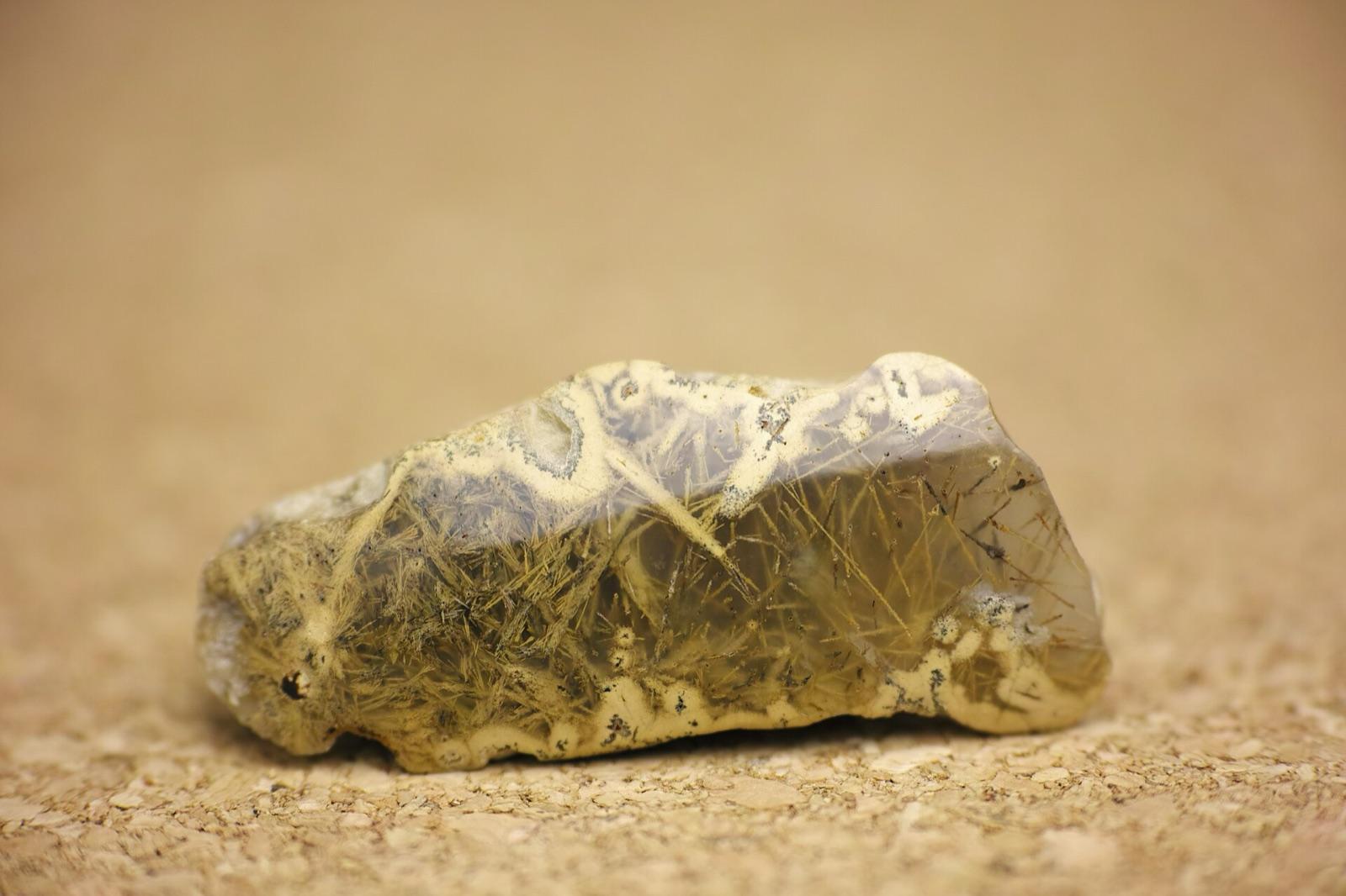
The beach at Moclips lies within Washington's Seashore Conservation Area, documented in rockhounding guides for the agate and jasper that wash in along the tideline and stream gravels.
Agate, Jasper
 Top pick
Lewis County
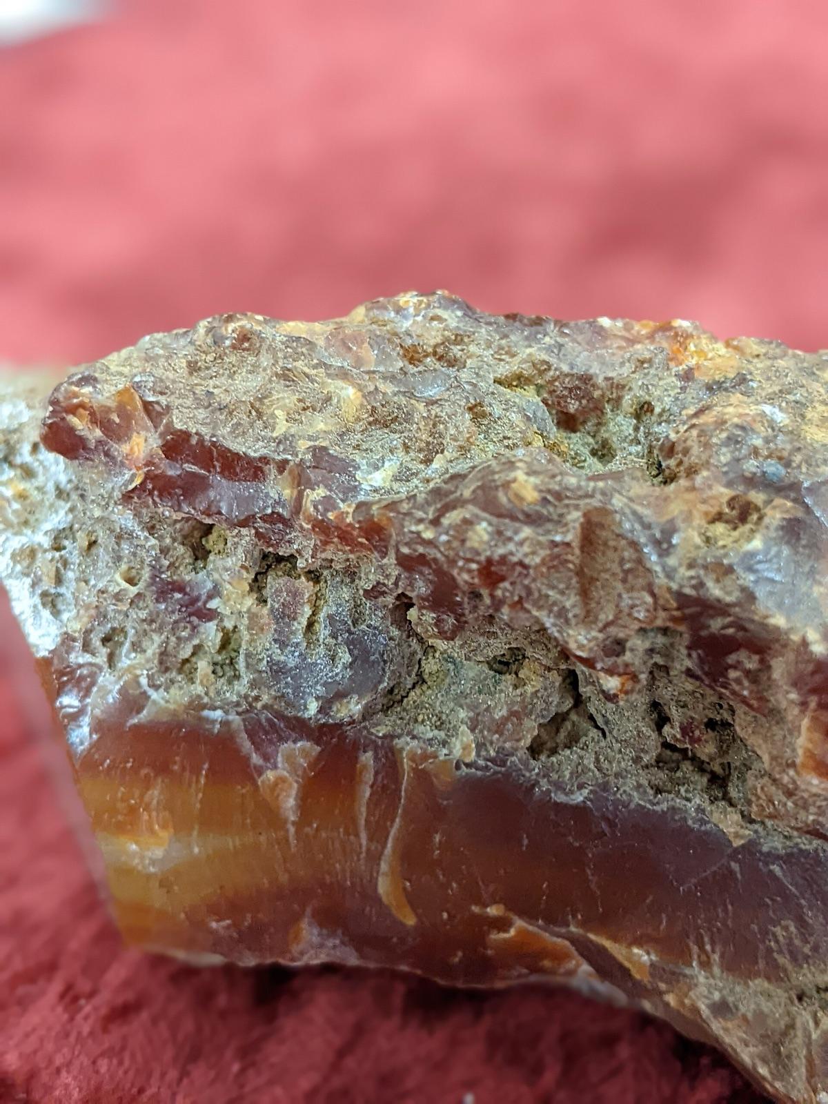
The Washington Geological Survey's gemstone report records that hundreds of pounds of agate have been taken between Adna and Pe Ell, in the heart of Lewis County's carnelian-agate country.
Agate, Carnelian, Chalcedony, Geode
 Top pick
Pacific County
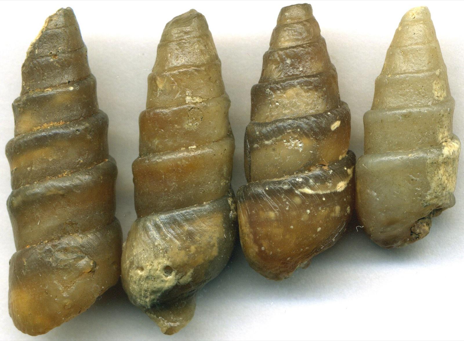
The Washington Geological Survey documents light-gray to yellowish-gray chalcedony casts of fossil clams in the Willapa Hills, some holding trapped water that shifts when the specimen is turned, a feature collectors call enhydros.
Agatized Fossil Shell
1 place in Washington where you pay to dig and keep what you find. Prices and seasons change, so check with the operator before you drive out.
23 clubs in Washington. Clubs run field trips, shows and workshops, and many trips go to private claims you can't reach alone.
Open the RockHoundR app to see Washington on a real map with public land overlays, weather, geology, and your saved finds.

