Every rockhounding spot on one map
Filter 2,800+ mapped locations across the United States and Canada by country, mineral, region, and land access: public, paid, or permission-required. Tap any pin for coordinates and the full spot page.
Prefer a list? Browse spots by country or where to find rocks & minerals.
- mapped spots
- 2,800+
- U.S. states
- 50
- CA provinces
- 13
- hand-picked
- 190
mapped spots
U.S. states
CA provinces
hand-picked
How to read the map
- Public
- Restricted
- Top pick
Public spots use the green marker. Paid, permission, and unverified spots all use the red marker (the map groups them as Restricted), and hand-picked top picks add a gold ring. Here is what each access label means.
- Public
Open collecting on public land. Confirm local rules before you dig.
- Paid / fee
Fee-dig mines and pay-to-prospect sites with managed access.
- Permission
Private or restricted ground. Ask the owner or agency first.
- Unverified
Access is not confirmed yet. Always check locally before you collect.
Popular rockhounding states
Each state page lists every mapped spot, top minerals, county breakdowns, and public-land notes.
- Rockhounding in Oregon74 spots · 23 counties
- Rockhounding in Utah246 spots · 29 counties
- Rockhounding in Arizona52 spots · 6 counties
- Rockhounding in California97 spots · 22 counties
- Rockhounding in Arkansas32 spots · 7 counties
- Rockhounding in Nevada118 spots · 16 counties
- Rockhounding in North Carolina198 spots · 56 counties
- Rockhounding in Texas93 spots · 50 counties
- Rockhounding in New Mexico119 spots · 26 counties
- Rockhounding in Wyoming82 spots · 19 counties
- Rockhounding in Montana87 spots · 30 counties
- Rockhounding in Idaho114 spots · 33 counties
Popular minerals to find
Per-mineral pages show the best states, mapped concentrations, and identification tips.
- Where to find agate380 spots · 12 states
- Where to find petrified wood169 spots · 12 states
- Where to find quartz445 spots · 12 states
- Where to find jasper352 spots · 12 states
- Where to find amethyst135 spots · 12 states
- Where to find obsidian15 spots · 5 states
- Where to find garnet192 spots · 12 states
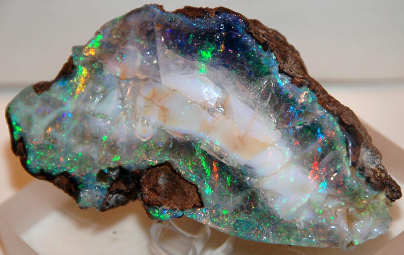
- Where to find opal44 spots · 12 states
- Where to find fossils89 spots · 12 states
- Where to find fluorite124 spots · 12 states
- Where to find tourmaline79 spots · 12 states
Best rockhounding spots
190 hand-picked
Standout spots from the map above, chosen for unusual mineralogy, documented public access, or both. Each card opens the full coordinates and access notes.
 Top pick
San Domingo Wash
PublicMaricopa County, Arizona
San Domingo Wash is a documented Au-Pt placer district in the western foothills of the Wickenburg Mountains, with Mindat and USGS-derived records tying the gold to stream-placer concentration. It stands out for Phoenix-area collectors because the target is a named historic placer system, not scattered speculative gold ground.
Gold
 Top pick
Neptune Mine near Grays Spring
PublicPima County, Arizona
Neptune Mine is a focused Arizona fluorite locality, with Mindat and MRDS records describing a former fluorspar mine where fluorite occurs in lenses and stringers along a schist-granite contact zone. The site adds mineral diversity to the Arizona list because it is a documented industrial-mineral occurrence rather than another chalcedony or placer-gold wash.
Fluorite
 Top pick
Red Rover mine
PublicMaricopa County, Arizona
Red Rover is a compact Cave Creek district copper-silver stop, with Mindat listing chalcocite and tetrahedrite-group minerals and Western Mining History tying the mine to copper, silver, and gold. It is notable because those sulfide minerals give the Maricopa County list a real ore-mineral locality, not just agate, jasper, and quartz float.
Chalcocite, Tetrahedrite
 Top pick
1 mi. N of old Three-Way drive-in theater
PublicGreenlee County, Arizona
Black Hills is one of Arizona's clearest public fire-agate localities, with BLM stating that fire agate is the principal attraction and that the site is open for public digging without fees or permits. The locality stands out because the collecting target is specific, chalcedony with opal-like color play in volcanic deposits, and the land manager publishes both access and collecting context.
Fire Agate, Chalcedony
 Top pick
York Area
PublicGreenlee County, Arizona
Fire agate is the reason the York and Duncan country earns the first Arizona slot: BLM identifies the nearby Round Mountain area as a public rockhounding destination, and its Arizona brochure lists fire agate as a notable Safford Field Office gemstone. The broader York area adds banded agate, carnelian, and jasper, so the site represents southeastern Arizona's volcanic chalcedony ground rather than a single-mine specimen stop.
Fire Agate, Banded Agate, Carnelian, Jasper
 Top pick
Kingman Feldspar Mine
PublicMohave County, Arizona
Kingman Feldspar Mine represents northwestern Arizona pegmatite collecting, with documented feldspar-quartz workings and rare-earth allanite from the Kingman area. It rounds out the top 10 because the mineral suite, microcline, quartz, and allanite, is geologically different from Arizona's better-known fire agate, turquoise, and placer-gold localities.
Allanite, Microcline, Quartz
 Top pick
Area near Meadow Creek Pass
PublicMohave County, Arizona
Meadow Creek Pass belongs to the same western Arizona volcanic-desert collecting belt that gives Mohave County its agate, chalcedony, jasper, and fire-agate reputation. It earns a place because the material suite is broader than a single color of agate, while BLM's Arizona guidance specifically flags fire agate on Kingman Field Office public lands.
Fire Agate, Grape Agate, Chalcedony, Jasper
 Top pick
On surface around Rich Hill
PublicYavapai County, Arizona
Rich Hill is Arizona's benchmark coarse-gold placer, documented by USGS as part of the Weaver district and by later geochemical work for nugget-rich placer units. Its importance is not just production history: the locality is specifically known for surface and shallow placer gold concentrated around Rich Hill, Antelope Creek, and Weaver Creek.
Gold Nugget
 Top pick
Under Burro Creek Bridge
PublicMohave County, Arizona
Burro Creek is a Mohave County agate landmark, with Mindat recording both the Burro Creek agate occurrence and agate in the Lower Burro Creek Wilderness Area. The site is especially useful for lapidary collectors because the material is colorful chalcedony-family float tied to a well-known BLM desert drainage, not a vague county-wide agate listing.
Pink Agate
 Top pick
Area around Diamond Point Lookout
PublicGila County, Arizona
Diamond Point is a managed Forest Service crystal site where clear, doubly terminated quartz crystals weather out of cavities in the Devonian Martin Formation. The combination of published geology, a defined 35-acre collection area, and a 10-pound-per-person daily limit makes it one of Arizona's strongest legal quartz localities.
Quartz
 Top pick
Unnamed Location (Magnet Cove area)
PublicHot Spring County, Arkansas
Magnet Cove is a classic alkaline igneous complex, noted in USGS work for nepheline syenite, carbonatite, and titanium-bearing minerals such as perovskite and titanite. Its unusual Cretaceous intrusive rocks make this small Hot Spring County area one of Arkansas's most mineralogically distinctive collecting districts.
Sphene, Nepheline Syenite
 Top pick
Cove Creek Bridge
PublicHot Spring County, Arkansas
Kimzeyite and perovskite give the Cove Creek Bridge area its weight: Perovskite Hill and the nearby Kimzey carbonatite localities are documented Magnet Cove occurrences rather than generic creek gravel. The appeal is the chance to study loose material tied to Arkansas's alkaline-carbonatite complex, where apatite, magnetite, monticellite, and zirconium-bearing garnet occur in a tight geologic setting.
Apatite, Monticellite, Magnetite, Perovskite
 Top pick
Wegner Quartz Mines
PublicMontgomery County, Arkansas
Clear hydrothermal quartz is the draw here, part of the Ouachita Mountain quartz belt that USGS and the Arkansas Geological Survey describe as one of western Arkansas's signature mineral resources. The Mount Ida area is especially useful because quartz-bearing veins and crystal pockets occur close to established digging operations.
Quartz
 Top pick
Mount Ida
PublicMontgomery County, Arkansas
Mount Ida sits in the heart of Arkansas's Ouachita quartz province, where hot fluids moved through fractured Paleozoic sandstone, shale, and chert to form crystal-bearing veins. That regional geology, documented by USGS and the Arkansas Geological Survey, is why the area remains the state's clearest benchmark locality for rock crystal collecting.
Quartz
 Top pick
Unnamed Quarry (Wavellite)
PublicMontgomery County, Arkansas
Mauldin Mountain wavellite is not an interchangeable green phosphate, Mindat and Arkansas Geological Survey references tie the quarries to botryoidal wavellite, variscite, planerite, and related phosphate minerals. The locality stands out because the best material shows radial, spherical aggregates that make the Montgomery County occurrence recognizable in collections.
Wavellite
 Top pick
Crater of Diamonds State Park
Paid / feePike County, Arkansas
Crater of Diamonds is exceptional because visitors search the eroded surface of a diamond-bearing Prairie Creek lamproite and may keep diamonds and other minerals they find. Arkansas State Parks and the Arkansas Geological Survey both document the park's volcanic pipe, its 37-acre search field, and its companion minerals, including amethyst, garnet, jasper, and agate.
Diamond, Amethyst, Garnet, Jasper
 Top pick
Prairie Creek
PublicPike County, Arkansas
Prairie Creek is the geologic source behind the Crater of Diamonds field, a lamproite diatreme with diamonds plus mantle and alteration minerals such as chrome diopside, epidote, garnet, hematite, and amethyst. Its value as a rockhounding landmark comes from that rare volcanic pipe, not from ordinary stream gravel.
Amethyst, Diopside, Epidote, Garnet
 Top pick
Yellville Mines
PublicMarion County, Arkansas
Yellville belongs to north Arkansas's historic lead-zinc belt, where Arkansas Geological Survey summaries record galena, sphalerite, and smithsonite production from Marion County and nearby Ozark districts. The mine-dump setting is notable because it exposes a compact suite of sulfide and carbonate zinc minerals in a state better known to many collectors for quartz and diamonds.
Galena, Pyrite, Smithsonite, Sphalerite
 Top pick
Lake Catherine (South Side)
PublicGarland County, Arkansas
The south side of Lake Catherine is tied to Garland County fluorite occurrences noted in Arkansas Geological Survey mineral-deposit reports and Mindat locality records. That makes the site a focused stop for a single, recognizable mineral rather than a broad mixed-gravel locality.
Fluorite
 Top pick
Bauxite Quarries
PublicSaline County, Arkansas
Saline County is one of the two districts in the Arkansas bauxite region, a roughly 275-square-mile belt described by the Arkansas Geological Survey and USGS as the state's historic aluminum-ore province. The quarries stand out because the material is tied to weathered syenite and related intrusive rocks rather than ordinary clay or ironstone.
Bauxite, Heliotrope Bauxite
 Top pick
Happy Camp Jade Mines
PublicSiskiyou County, California
Happy Camp gives the top-10 list a Klamath Mountains jade and gold locality rather than another Mojave silica field. Mindat records ferro-actinolite-tremolite series material at the Chan Jade Mine and placer native gold from the Happy Camp region, which fits the area's serpentinite and historic placer-mining setting.
Jade, Gold, Serpentine, Gold-laced Jade
 Top pick
Trinity River
PublicTrinity County, California
The Trinity River is a north-state benchmark because it combines historic placer-gold country with Klamath Mountains metamorphic and ultramafic source rocks. USGS mapping documents the basin's complex bedrock setting, while the RockHoundR candidate minerals add chalcedony, jasper, jade, and petrified wood to the river's placer-gold identity.
Chalcedony, Gold, Jasper, Jade
 Top pick
Glass Mountain
PublicSiskiyou County, California
Glass Mountain represents California's northern volcanic-glass collecting better than any ordinary agate wash, with Forest Service materials identifying designated obsidian collecting areas in the Modoc country. Mindat's Siskiyou County records place Glass Mountain and Little Glass Mountain among mapped pumice and obsidian-related localities, tying the material directly to young Cascade volcanism.
Obsidian
 Top pick
Jacolitos Canyon
PublicFresno County, California
Jacolitos Canyon adds a Coast Range sedimentary and fossil-bearing locality to a list otherwise dominated by volcanic glass, agate, jade, and gold. USGS work on the Coalinga district documents the Jacalitos fossil context, while the candidate record makes the site useful for jasper, petrified wood, and fossilized coral on lawful public ground.
Jasper, Petrified Wood, Fossilized Coral
 Top pick
New Almaden Area Mines
PublicSanta Clara County, California
New Almaden is not just a cinnabar stop, it is one of California's classic mercury districts, hosted in altered serpentinite and silica-carbonate rock. Mindat records cinnabar, native mercury, metacinnabar, apophyllite, gyrolite, chalcedony, and opal, while USGS Professional Paper 360 makes the district one of the state's best documented quicksilver localities.
Chert, Cinnabar, Apophyllite, Gyrolite
 Top pick
Big Sur area
PermissionMonterey County, California
Big Sur is California's clearest public jade locality because sanctuary rules specifically allow loose nephrite collection in the Jade Cove authorized area below mean high tide. Mindat records jade and nephrite at Big Sur, and Los Padres National Forest planning documents note historic jade collecting around Plaskett Creek, Jade Cove, Willow Creek, and offshore.
Jade, Nephrite, Serpentine
 Top pick
Unnamed Location (Fire Agate)
PublicRiverside County, California
The Wiley Well and Mule Mountains area is one of California's best documented public desert collecting districts, with BLM specifically identifying the Wiley Well District Geode Beds for rockhounding. Mindat records nearby fire agate, chalcedony, agate, amethyst, quartz, and opal, giving the area more mineral range than a single-specimen stop.
Chalcedony, Fire Agate
 Top pick
Afton Canyon
PermissionSan Bernardino County, California
Afton Canyon pairs documented BLM rockhounding access with a strong Mojave silica suite: Mindat lists opal, opalite, chalcedony, plume agate, agate-jasper, petrified wood, and jasper in the canyon area. The locality also has unusual field context because the Mojave River flows above ground here year-round, cutting through one of the region's more recognizable volcanic and sedimentary exposures.
Opalite, Jasper
 Top pick
El Paso Mountains
PublicKern County, California
The El Paso Mountains stand out because BLM identifies the area as a place where rock hounds find material among dark volcanic mesas, red buttes, and fossil-bearing badlands. Mindat ties the range and its Last Chance Canyon localities to agate-jasper, opal, gold, and petrified wood, a compact record of Mojave volcanic and sedimentary collecting.
Agate, Opal, Jasper, Gold
 Top pick
Gem Hill
PublicKern County, California
Gem Hill is a focused Kern County silica locality, with Mindat recording agate, chalcedony, iris agate, jasper, petrified wood, native gold, and uranium minerals nearby. Its appeal is the Rosamond Hills mix of lapidary material and desert mineralization, but claim and parcel checks matter because the district has a long mining history.
Agate, Chalcedony, Jasper, Uraninite
 Top pick
Mount Antero
PublicChaffee County, Colorado
Mount Antero is the highest gem locality in the United States, with aquamarine and beryl occurring in granite cavities above timberline near its 14,269-foot summit. Aquamarine is Colorado's state gemstone, and the peak also yields phenakite, topaz, smoky quartz, and fluorite. The collecting ground lies in San Isabel National Forest, where the Forest Service permits casual hand-tool collecting for personal use on open land.
Aquamarine, Beryl, Phenakite, Smoky Quartz
 Top pick
Italian Mountain
PublicGunnison County, Colorado
Italian Mountain holds one of the few genuine lapis lazuli localities in the United States, a contact-metamorphic deposit in marble that has produced some of the largest North American lapis specimens. Grossular garnet, diopside, pyrite, and calcite occur in the same skarn. The site sits on open Gunnison National Forest land outside designated wilderness.
Lapis Lazuli, Grossular Garnet, Diopside, Pyrite
 Top pick
Quartz Creek (Brown Derby)
PublicGunnison County, Colorado
The Quartz Creek, or Brown Derby, district is Colorado's most fractionated lithium-cesium-tantalum pegmatite field, mapped by the USGS as more than 1,800 pegmatite bodies. They carry beryl, lepidolite, pink and green tourmaline, and rare columbite-tantalite. The dikes sit on Gunnison National Forest land where personal hobby collecting with hand tools is allowed.
Beryl, Tourmaline, Lepidolite, Albite
 Top pick
Crystal Mountain
PublicLarimer County, Colorado
The Crystal Mountain pegmatite district, mapped in USGS Bulletin 1011, contains beryl in roughly a quarter of its pegmatites, including aquamarine, alongside muscovite, fluorapatite, and bismutite. The district sits on Roosevelt National Forest along upper Buckhorn Creek west of Fort Collins. Garnet and schorl tourmaline occur in the zoned pegmatites.
Beryl, Aquamarine, Fluorapatite, Muscovite
 Top pick
Wolf Creek Pass
PublicMineral County, Colorado
Wolf Creek Pass cuts through Conejos Formation basalts whose gas cavities are lined with zeolites, including mordenite reported among the finest in North America, alongside amethyst-bearing geodes. Heulandite, chabazite, and calcite occur in the same amygdules. The collecting exposures along US 160 sit on San Juan and Rio Grande National Forest land outside designated wilderness.
Amethyst, Mordenite, Heulandite, Chabazite
 Top pick
Tallapoosa River
PublicCarroll County, Georgia
The gravels of the Little Tallapoosa River near Carrollton carry small rubies and garnets shed from nearby vein exposures, with garnet and olivine also reported in outcrops just off GA 166. The corundum is found about a mile or so east of town in the river gravels. It is one of the more accessible ruby-bearing localities in west Georgia.
Ruby
 Top pick
Windy Ridge and Mineral Bluff
PublicFannin County, Georgia
The Mineral Bluff area of Fannin County is the classic source for staurolite "fairy crosses," the twinned crystals that are Georgia's state mineral. The crystals weather out of mica schist and accumulate in residual soil, where the dark twins stand out against the red clay, especially after rain. The right-angle (90-degree) twins are the prized form and are scarcer than the more common 60-degree crosses.
Staurolite
 Top pick
Soquee River
PublicHabersham County, Georgia
Habersham County lies along a kyanite-mica schist belt roughly 30 miles long, and the Soquee (Soque) River drainage near Clarkesville is a recognized source of bladed blue kyanite. The mineral weathers out of the schist and collects in the river gravels and float. The same belt extends into neighboring Rabun County, making this one of Georgia's principal kyanite regions.
Kyanite
 Top pick
Baggs Branch
PublicLumpkin County, Georgia
Baggs Branch sits in the Dahlonega gold belt of Lumpkin County, the district that touched off the 1829 Georgia gold rush and yielded an estimated 400,000 to 500,000 ounces. Fine placer gold occurs in the gravels of the small Chattahoochee and Etowah tributary streams that drain the belt. Hand panning these streambeds is the traditional recreational method here.
Gold
 Top pick
Towns County
PublicTowns County, Georgia
Towns County, in the far northeastern mountains, is one of Georgia's better-known sources of gem-quality amethyst, documented at several localities including the Garrett Mine near Titus. The purple quartz occurs in quartz veins and weathers loose into the surrounding soil and stream gravels. The surrounding Blue Ridge schists and pegmatites also yield clear and smoky quartz.
Amethyst
 Top pick
Chattahoochee River
PublicMuscogee County, Georgia
Where the Chattahoochee River crosses the Fall Line at Columbus, its gravels carry a varied suite of silica minerals: chalcedony, chert, flint, jasper, opal, and opalized wood. The material washes down from the Coastal Plain formations and concentrates on bars and in the river's gravel. It is one of the few signature collecting opportunities reachable from a major Georgia city.
Chalcedony, Chert, Flint, Jasper
 Top pick
Girard
PublicBurke County, Georgia
The Girard area produces "Savannah River agate," a banded mix of agate, jasper, chert, and opalite that forms in the Coastal Plain near the Burke and Screven county line. The material tumbles and cabs into colorful pieces ranging from brown mottled stone to soft greens, yellows, and violets. The host Oligocene-age deposits also carry marine fossils alongside the chalcedony.
Savannah River Agate, Chalcedony, Quartz, Silicified Oolite
 Top pick
Elberton
PermissionElbert County, Georgia
The Elberton district of Elbert County is a long-documented pegmatite area that has produced aquamarine beryl, including masses up to several inches across, along with quartz, garnet, and tourmaline. The aquamarine is characteristically fractured by regional stress, with the breaks healed by tiny later beryl crystals. Cook's "Minerals of Georgia" records the Harmony Church pegmatite among the aquamarine sources here.
Aquamarine, Garnet, Quartz, Tourmaline
 Top pick
Dodge County
PermissionDodge County, Georgia
Dodge County is the heart of the georgiaite strewn field, the source of most of the roughly 1,700 to 2,000 tektites recovered in Georgia. Georgiaites are a rare olive-green natural glass tied to a Late Eocene impact, and Dodge and neighboring Bleckley counties account for the bulk of finds. New specimens still turn up, including one recovered in 2017.
Tektites
 Top pick
Withlacoochee River
PublicLowndes County, Georgia
The Withlacoochee River near the Florida line is one of the best remaining places in Georgia to find agatized coral, fossil coral colonies replaced by chalcedony. The material derives from the Oligocene Suwannee Limestone and is recovered from the riverbed and bank gravels of Lowndes County. With many Florida coral sites now closed, this stretch is a regionally significant locality.
Agatized Coral
 Top pick
Emerald Creek
PublicShoshone County, Idaho
Emerald Creek is Idaho's signature public star-garnet locality, with the Forest Service noting that commercial quantities of star garnet are otherwise known only from India. The managed sluice area gives collectors a rare legal way to search for dodecahedral almandine garnets while keeping digging out of the streambed.
Almandine Garnet
 Top pick
Idaho City
PublicBoise County, Idaho
Idaho City anchors the Boise Basin, one of Idaho's best-documented historic placer-gold regions. USGS publications identify the basin northeast of Boise as a major dredging and placer area, and nearby Grimes Pass district records add quartz and gold mineral context for modern, land-status-aware panning and prospecting.
Quartz, Garnet
 Top pick
Bruneau Canyon
PublicOwyhee County, Idaho
Bruneau Canyon stands out for Bruneau jasper, the orbicular and scenic jasper variety tied to the Bruneau River canyon in Owyhee County. Idaho Department of Lands lists Bruneau jasper about 50 road miles south of Bruneau, and Mindat treats the canyon deposits as a named locality, making it one of the state's most recognizable lapidary sources.
Bruneau Canyon Jasper
 Top pick
Seven Devils Mining District
PublicAdams County, Idaho
Seven Devils is a classic Idaho skarn and copper district, where Idaho Geological Survey maps and reports emphasize limestone-garnet belts, copper deposits, and lime-silicate minerals. For collectors, that translates into a broader mineral suite than most Idaho sites: garnet, epidote, malachite, zoisite, and related contact-metamorphic material.
Epidote, Red Garnet, Pink Garnet, Malachite
 Top pick
Challis
PublicCuster County, Idaho
Challis represents the Challis Volcanics better than a single protected petrified-forest stop, with Idaho Department of Lands listing nearby red agate, banded opal, and petrified-wood localities in Custer County. Mindat records opal from the Challis area and documents agate collecting in the same volcanic province, which makes it a practical tenth pick for silica collectors.
Red Agate, Banded Opal
 Top pick
Dismal Swamp
PublicElmore County, Idaho
Dismal Swamp is a focused Elmore County locality for smoky quartz and topaz, both listed for the area by Idaho Department of Lands and Mindat. It is a more mineral-specimen-oriented choice than many Idaho agate fields, with quartz-family collecting tied to the Rocky Bar mining district and nearby granitic terrain.
Smoky Quartz, Topaz
 Top pick
Succor Creek
PublicOwyhee County, Idaho
Succor Creek is one of the clearest public names in Owyhee agate collecting, especially for red-and-green nodules and thunderegg-style cavities. Idaho Department of Lands calls out the eastern fringe of Succor Creek specifically, and the broader Owyhee volcanic field gives the site the silica-rich source rocks behind its agate and jasper float.
Red Agate, Green Agate
 Top pick
Mackay
PublicCuster County, Idaho
Mackay is the best Custer County mine-district pick for copper minerals, with Mindat documenting malachite and related species across the Alder Creek and White Knob district. Idaho Department of Lands also lists Custer County districts for azurite, malachite, and other base-metal minerals, so the site has stronger mineral documentation than a generic scenic stop.
Azurite, Chalcopyrite, Chrysocolla, Malachite
 Top pick
Little Wood River
PublicBlaine County, Idaho
Little Wood River is the strongest Blaine County pick because the same drainage is listed for green and moss agate by Idaho Department of Lands and has Mindat specimen records from the Little Wood Reservoir area. Its agate, chalcedony, and jasper add a useful south-central Idaho counterpoint to the better-known Owyhee localities.
Agate, Chalcedony, Jasper
 Top pick
Parker Mountain
PublicLemhi County, Idaho
Parker Mountain gives Lemhi County a documented agate and chalcedony locality outside the crowded southern Idaho fields. Idaho Department of Lands lists green and green-moss agate near Parker Mountain, while Mindat records agate and chalcedony within the Parker Mountain mining district mineral list.
Agate, Chalcedony
 Top pick
Catherine Mountain (Donnell Pond)
PublicHancock County, Maine
Catherine Mountain holds a nineteenth-century molybdenite prospect where molybdenite occurs in granite pegmatite, rare vugs, and fractures, alongside reported scheelite and wolframite. The peak sits inside the state-administered Donnell Pond Public Reserved Land, where the Maine Geological Survey allows casual hobby collecting without a permit.
Molybdenite, Scheelite, Fluorapatite, Magnetite
 Top pick
Edgecomb Quarry (Schmid Preserve)
PublicLincoln County, Maine
The Edgecomb pegmatite pits sit inside the 766-acre Schmid Preserve, town land laced with more than seven miles of public trails, where 1880s feldspar and mica workings exposed almandine garnet, beryl, and aquamarine. The preserve is free and open to the public. Smoky quartz and muscovite occur in the same pegmatite.
Almandine Garnet, Beryl, Aquamarine, Smoky Quartz
 Top pick
Swift River at Coos Canyon
PublicOxford County, Maine
The Swift River at Coos Canyon in Byron carries fine glacial gold and is the most famous recreational gold-panning spot in New England, with flakes recoverable from bedrock crevices in the roadside gorge. Nine acres of the canyon were permanently protected through Maine's Land for Maine's Future program in 2006. Garnet and magnetite concentrate in the same black sand.
Gold, Garnet, Magnetite, Staurolite
 Top pick
Deer Hill (White Mountain National Forest)
PublicOxford County, Maine
Deer Hill is a US Forest Service designated mineral collecting area in the White Mountain National Forest, known for amethyst recovered by screening the sandy soil. Feldspar, beryl, garnet, columbite, and pyrite are also documented at the site. Hobby collecting is allowed under a no-fee day permit.
Amethyst, Beryl, Feldspar, Garnet
 Top pick
Lord Hill (White Mountain National Forest)
PublicOxford County, Maine
Lord Hill is a granite pegmatite in the White Mountain National Forest where more than 50 minerals have been recorded, most famously large white topaz and smoky quartz crystals encrusted with rare phenakite. The US Forest Service runs it as a designated collecting area open under a no-fee day permit. Feldspar and garnet round out the finds.
Topaz, Phenakite, Smoky Quartz, Feldspar
 Top pick
Mount Apatite
PublicAndroscoggin County, Maine
Mount Apatite is a lithium-rich pegmatite district where the Pulsifer Quarry produced some of the finest purple apatite crystals in the world, alongside green and pink tourmaline, aquamarine, and lilac lepidolite. The historic feldspar quarries now sit inside Auburn city parkland, making this one of the few Maine gem localities with genuine free public access. Garnet and smoky quartz turn up in the same dumps.
Green Tourmaline, Pink Tourmaline, Aquamarine, Purple Apatite
 Top pick
Keweenaw Point
PublicKeweenaw County, Michigan
The exposed Lake Shore Traps along the wave-washed tip of the Keweenaw Peninsula carry agate-filled amygdules and datolite, with larger Keweenaw agates working loose from a narrow gravel band at the waterline. The State of Michigan and The Nature Conservancy secured public access to roughly 6,275 acres here in 2003, keeping the Point open for shoreline collecting. Thomsonite and chalcedony round out the finds.
Keweenaw Agate, Thomsonite, Datolite, Chalcedony
 Top pick
Lake Superior Beach (Ontonagon)
PublicOntonagon County, Michigan
The Lake Superior shoreline around Ontonagon is among the most agate-rich in Michigan, with the stretch toward Copper Harbor noted for unusually heavy agate cover along with quartz, jasper, and occasional copper. Public township and roadside beaches give free access to the wave-sorted gravel where Keweenaw agates and thomsonite turn up. The best searching follows a storm that reworks the gravel.
Keweenaw Agate, Thomsonite, Chalcedony, Jasper
 Top pick
Manitou Island
PublicKeweenaw County, Michigan
The 93-acre Manitou Island Light Station Preserve, owned by the Keweenaw Land Trust off the tip of the Keweenaw, is one of the few outer-island shores expressly open to the public for rock collecting. Its rocky Lake Superior shoreline yields Lake Superior agates and includes a visible quartz vein. The land trust acquired the preserve from the federal government in 2004.
Lake Superior Agate, Quartz
 Top pick
Jasper Knob (Jasper Hill)
PublicMarquette County, Michigan
Jasper Knob in Ishpeming is a bald hilltop made entirely of jaspilite, a 1.87-billion-year-old banded iron formation of alternating red jasper and silvery specular hematite. The folded, polished bands are among the best easily reached banded-iron exposures in North America. A short foot trail off Hill Street leads straight to the outcrop.
Jaspilite, Jasper, Hematite, Specular Hematite
 Top pick
Petoskey Beaches (Little Traverse Bay)
PublicEmmet County, Michigan
Little Traverse Bay in Emmet County is the most reliable place in Michigan to find Petoskey stones, the state stone, which are fossilized Hexagonaria colonial coral that show their honeycomb pattern best when wet. Petoskey State Park offers about a mile of sand-and-rock Lake Michigan shoreline, and nearby Magnus City Park adds a free-parking beach within walking distance of downtown. Charlevoix stones and other Devonian fossils turn up in the same gravel.
Petoskey Stones
 Top pick
Charles Mears State Park Beach
PublicOceana County, Michigan
Charles Mears State Park puts almost 2,000 feet of Lake Michigan beach within easy reach in Pentwater, where wave-sorted gravel turns up Petoskey stones and other glacially transported Great Lakes specimens. The shoreline below the ordinary high-water mark is public land, so beachcombing is broadly allowed along the water's edge. It is one of the more accessible west-coast beaches for casual collectors.
Petoskey Stones, Agate, Fossils
 Top pick
Presque Isle Shoreline
PublicPresque Isle County, Michigan
The Presque Isle peninsula on Lake Huron is documented for an unusual mix of agate, chalcedony geodes, and brown sandstone veined with calcite, finds that gather along its rocky shoreline after summer storms. The beach below the ordinary high-water mark is public land, giving collectors legal footing along the water's edge. Petoskey stones and jasper occur in the same gravel.
Agate, Chalcedony Geode, Sandstone With Calcite Veins
 Top pick
Rockport Recreation Area
PublicAlpena County, Michigan
Rockport State Recreation Area opens a 300-acre former limestone quarry whose floor is scattered with Devonian fossils about 400 million years old, including Petoskey stones, Favosites honeycomb coral, brachiopods, and crinoids. It is one of the few Michigan state sites where the DNR openly invites visitors to keep up to 25 pounds of fossils per person each year. Pyrite also occurs in the quarry beds.
Petoskey Stones, Fossilized Coral, Brachiopods, Crinoid Stems
 Top pick
Gallatin
PublicDaviess County, Missouri
Gallatin sits on the Grand River in glaciated Daviess County, and the river gravels here are a documented source of petrified wood, agate, jasper, and chalcedony reworked from glacial drift. It gives collectors a defined river-access point within the broader northwestern Missouri agate country. Petrified wood is the standout find, with pieces showing clear cell structure.
Agate, Chalcedony, Jasper, Petrified Wood
 Top pick
Gentry County
PublicGentry County, Missouri
Gentry County in far northwestern Missouri lies squarely in glacial-drift country, where ice-rafted Lake Superior agates, jasper, and petrified wood are scattered through till and reworked into the area's stream gravels. It is one of the recognized northwest Missouri counties for agate hunting, alongside Daviess, Grundy, and Livingston. The agates carry the classic red-and-white fortification banding of the Lake Superior type.
Lake Superior Agate, Jasper, Fossils, Petrified Wood
 Top pick
Daviess County
PublicDaviess County, Missouri
Daviess County lies in the glaciated plains of northern Missouri, where Pleistocene ice sheets carried Lake Superior agates south from the Great Lakes basin and dropped them in glacial drift and stream gravels. Collectors work the area's creeks and the Grand River gravels for banded fortification agate, jasper, petrified wood, and fossils. The agates are tumble-rounded and frost-pitted, distinct from the local sedimentary chert.
Lake Superior Agate, Jasper, Fossils, Petrified Wood
 Top pick
Grundy County
PublicGrundy County, Missouri
Grundy County rounds out the cluster of glaciated northern Missouri counties that yield ice-transported Lake Superior agates, with mindat documenting Lake Superior agate from the county. Its creeks and the Thompson and Weldon river gravels rework glacial drift, freeing agate, jasper, and petrified wood. The material is the same banded, tumble-rounded agate prized by Midwest collectors.
Lake Superior Agate, Jasper, Fossils, Petrified Wood
 Top pick
Alexandria & Wayland
PublicClark County, Missouri
Clark County is the most productive geode-collecting county in Missouri, sitting at the southwestern edge of the famous Keokuk geode district along the Des Moines and Mississippi drainages. Geodes weather out of the lower Warsaw Formation, a soft shaley limestone, and concentrate in creek and river gravels with quartz, calcite, and sulfide linings. The Alexandria and Wayland area near the Des Moines River mouth has long been a classic source.
Geode
 Top pick
Fabius River
PublicLewis County, Missouri
The Fabius River drainage in Lewis County cuts through the Warsaw Formation on the southern margin of the Keokuk geode belt, releasing geodes lined with quartz, calcite, aragonite, and trace sulfides into the river gravels. It extends the famous Clark County geode beds a county south and gives collectors a second, less-crowded drainage to work. Geodes here range from golf-ball size to grapefruit size.
Geode, Calcite, Malachite, Pyrite
 Top pick
La Grange
PublicLewis County, Missouri
The Mississippi River gravels around La Grange in Lewis County carry gem-quality agate, chalcedony, jasper, petrified wood, and the occasional Keokuk geode, all concentrated by the river and reworked glacial drift. Older accounts of Missouri minerals single out the large gravel deposits near La Grange as a source of beautiful agate specimens. The mix of Lake Superior agate carried south by glaciers and local silica makes the river bars unusually varied.
Agate, Chalcedony, Jasper
 Top pick
Lincoln
PublicBenton County, Missouri
Lincoln sits at the heart of the mozarkite country in Benton County, the source of Missouri's official state rock, a multicolored gem chert that weathers out of the Mississippian Burlington and Warsaw limestones. Freshly broken cobbles show red, pink, purple, and green banding against gray, and the town hosts an annual mozarkite festival built around the material. It is one of the few places in the country where this specific gem chert occurs in collectible quantity.
Chalcedony, Chert, Mozarkite, Galena
 Top pick
Warsaw
PublicBenton County, Missouri
Warsaw anchors the southern end of the Benton County mozarkite belt and sits on the Harry S. Truman Reservoir, where falling lake levels expose chert and mozarkite cobbles along the shoreline. The same Burlington and Warsaw limestone weathering that supplies Lincoln also feeds gravels and lakeshores around Warsaw, yielding banded gem chert plus agate and ordinary chert. It is a second strong access point for the state rock, with miles of public shoreline to walk.
Agate, Chert, Mozarkite
 Top pick
Elk River near Bee Bluff
PublicMcDonald County, Missouri
The Elk River in McDonald County is a clear, floatable Ozark stream whose gravel bars are packed with colorful Mississippian chert, including the locally prized blue and gray banded chert weathered from the surrounding Boone Formation. The river runs through Pineville and Noel with numerous public-access bars and ramps. It offers easy, family-friendly surface collecting away from the Tri-State mining district hazards.
Chert, Blue Chert
 Top pick
Calvert Hill Mine
PublicBeaverhead County, Montana
Calvert Hill Mine adds a tungsten-skarn flavor to the Montana list, with Mindat describing a surface mine in Cambrian Meagher Formation limestone and listing scheelite, garnet, beryl var. aquamarine, chalcopyrite, molybdenite, pyrite, and smoky quartz in the district. That mineral spread makes it a stronger educational pick than another agate bar from the same river system.
Scheelite, Garnet, Aquamarine, Tungsten
 Top pick
Rock Creek
PublicGranite County, Montana
Rock Creek is one of Montana's four classic sapphire districts, documented by USGS and GIA alongside the Missouri River, Dry Cottonwood Creek, and Yogo Gulch. Mindat records corundum, sapphire, ruby, garnet, hematite, kyanite, magnetite, and rutile from the district, giving the locality more mineral context than a simple gem-gravel stop.
Quartz, Sapphire
 Top pick
Ruby River
PublicMadison County, Montana
Ruby River is Montana's clearest garnet-focused pick in this candidate set, with nearby Mindat records listing almandine and broader Madison County garnet occurrences. Its appeal is narrow but strong: a recognizable metamorphic and placer-derived garnet target in a state otherwise dominated in popular collecting by sapphire and agate.
Almandine Garnet
 Top pick
Dry Cottonwood Creek
PublicDeer Lodge County, Montana
Dry Cottonwood Creek is one of the historic Montana sapphire fields named by USGS and GIA, discovered after the Missouri River bars and before Rock Creek and Yogo Gulch. It is less accessible and less active than some better-known sapphire districts, but that documented place in the state's corundum history makes it too important to omit.
Sapphire
 Top pick
Crystal Mountain Mine
PublicRavalli County, Montana
Crystal Mountain Mine is a focused fluorite locality, with Mindat tying the Ravalli County site to the Crystal Mountain Fluorspar Mine and listing fluorite with quartz and accessory phosphate and silicate minerals nearby. The spot broadens Montana's top list beyond sapphire, agate, and historic base-metal districts with a clear single-mineral identity.
White Fluorite, Green Fluorite, Purple Fluorite
 Top pick
Butte
PublicSilver Bow County, Montana
Butte is Montana's heavyweight ore-mineral locality, with MBMG and USGS work documenting complex copper, silver, manganese, and related vein mineralogy in the district. For collectors, the draw is not ordinary float but classic species tied to the Butte lodes, including bornite and rhodochrosite in a district with national-scale mining history.
Bornite, Pisanite, Rhodochrosite, Rhodonite
 Top pick
Pryor Mountains
PublicBig Horn County, Montana
The Pryor Mountains stand out for Dryhead-style agate, with Mindat listing agate and chalcedony from the range and a named Dryhead Agate Mine in the Bighorn River area. The same Big Horn County country also carries fossil-bearing sedimentary units, so the locality needs careful land-status and fossil-rule checks rather than casual blanket collecting.
Fossils, Agate, Chalcedony, Jasper
 Top pick
American Bar
PublicLewis and Clark County, Montana
American Bar belongs to the upper Missouri River sapphire province, where GIA traces gem-quality sapphire mining back to 1865. The associated heavy-mineral suite, including cassiterite, garnet, kyanite, topaz, gold, and chalcedony, makes the Missouri River bars one of Montana's most mineralogically varied placer settings.
Sapphire, Cassiterite, Chalcedony, Garnet
 Top pick
Yellowstone River (Billings area)
PublicYellowstone County, Montana
The Billings reach of the Yellowstone River is a benchmark Montana agate setting, where river gravels carry chalcedony, jasper, chert, and dendritic moss agate. Mindat records agate from Yellowstone County, and regional visitor and BLM guidance both point collectors toward public-land surface collecting rather than quarry or fee-pit material.
Montana Agate, Chalcedony, Chert, Jasper
 Top pick
Glendive
PublicDawson County, Montana
Glendive sits in eastern Montana's Yellowstone River agate belt, where gravel bars and nearby breaks are known for agate, jasper, and petrified-wood style silica material. The site earns its place because it represents the downstream end of the Montana agate story, where long river transport has already sorted and rounded much of the collectible material.
Agate, Jasper, Moss Opal
 Top pick
Virgin Valley
PermissionHumboldt County, Nevada
Virgin Valley is the United States' classic black-opal district, with USGS and Mindat both placing the opal field near the Oregon line in the Sheldon refuge country. Its strongest geologic feature is opal replacing mid-Miocene wood, including petrified wood and rare plant material, although most precious-opal ground is claimed and any collecting has to respect mining and refuge restrictions.
Agate, Chalcedony, Chert, Flint
 Top pick
Black Rock Desert
PublicPershing County, Nevada
Black Rock Desert belongs on the list because the collecting context is an enormous BLM-managed volcanic and basin landscape rather than a single small pit. Local rockhounding guidance for Black Rock-High Rock country highlights minerals, common fossils, and petrified wood rules, while BLM documents the area's national conservation status and broad public-land recreation framework.
Opalized Wood, Petrified Wood, Agate, Fire Opal
 Top pick
Garnet Hill
PublicWhite Pine County, Nevada
Garnet Hill is Nevada's clearest public rockhounding benchmark: BLM identifies it as the Ely District's designated rockhounding area, and Mindat ties the locality to almandine garnet in flow-banded rhyolite with lithophysae. The site stands out because its garnets are part of a documented volcanic setting, not an unnamed gravel patch, and access is organized around casual public collecting.
Garnet
 Top pick
Fernley Hills
PublicLyon County, Nevada
Fernley Hills is a practical western Nevada silica stop, with Mindat records documenting agate, chalcedony, opal, quartz, and zeolite minerals in the Fernley area. It earns a place because the material is tied to a named locality close to Reno-Sparks access, while still requiring parcel and claim checks before collecting.
Agate, Chert, Jasper
 Top pick
Lincoln Hill
PublicPershing County, Nevada
Lincoln Hill is unusually specific for a lapidary locality: Mindat and cited NBMG work document pink to lavender dumortierite in felsitic trachyte breccia, with quartz, andalusite, corundum, ganterite, and tourmaline in the same deposit. That focused borosilicate assemblage makes it a stronger pick than a generic Pershing County mining-district listing.
Blue Dumortierite, Pink Dumortierite
 Top pick
Coaldale
PublicEsmeralda County, Nevada
Coaldale is a useful Esmeralda County silica locality because the candidate data points to agate, chert, hyalite opal, jasper, and turquoise in a compact desert area. Mindat and NBMG district records help anchor the site in a named mining district, making it a better researched pick than a vague countywide agate listing.
Agate, Chert, Hyalite Opal, Jasper
 Top pick
Fish Lake Valley
PublicEsmeralda County, Nevada
Fish Lake Valley is notable for hot-spring mercury mineralization rather than ordinary desert float, with Mindat records describing opalized and silicified rhyolite-hosted rock carrying cinnabar and opal. The locality is a good Nevada example of silica-rich alteration, but mercury minerals and old workings make conservative collecting and hand-sample handling important.
Cinnabar, Opalite
 Top pick
Goldfield
PublicEsmeralda County, Nevada
Goldfield is one of Nevada's strongest mineralogical districts because Mindat documents a high-sulfidation quartz-alunite gold system with native gold, native silver, pyrite, alunite, tellurides, and several type-locality minerals. Its value for rockhounding research is the intensely altered volcanic-hosted setting, although the historic mine landscape demands careful attention to claims and mine hazards.
Alum, Pyrite, Quartz, Copper
 Top pick
San Antonio Mountains
PublicNye County, Nevada
The San Antonio Mountains add central Nevada range-scale diversity, with Mindat documenting a large Nye County assemblage that includes quartz, chalcedony, opal, fluorite, rhodochrosite, scheelite, sulfides, and several copper minerals. The dataset's jade, petrified wood, and wonderstone entry makes the area a lapidary contrast to nearby Tonopah and Goldfield metal districts, provided collecting stays on open public ground.
Jade, Petrified Wood, Wonderstone
 Top pick
White Basin
PublicClark County, Nevada
White Basin stands apart from Nevada's silica and precious-metal localities because it is a borate occurrence, with Mindat listing ulexite, colemanite, gypsum, halite, and related evaporite minerals from the Muddy Mountains district. NBMG and USGS discussions of Muddy Mountains borates give the site a stronger geologic footing than a casual listing of 'TV rock.'
Ulexite
 Top pick
Zuni Mountains
PublicCibola County, New Mexico
The Zuni Mountains give New Mexico's top ten a western forest-and-public-land agate field rather than another southern mining district. The candidate data's agate, chalcedony, jasper, and petrified wood suite aligns with New Mexico Bureau of Geology rockhound guidance and published Rockhounding New Mexico locality coverage for the Gallup, Grants, and Zuni Mountains region.
Agate, Chalcedony, Jasper, Petrified Wood
 Top pick
Harding Pegmatite Mine
PublicTaos County, New Mexico
Harding Pegmatite Mine is a preserved lithium-beryllium-tantalum pegmatite where UNM still allows small personal collecting under posted rules. New Mexico Geological Society and USGS-derived records document lepidolite, spodumene, beryl, microlite, apatite, muscovite, quartz, and related rare-element pegmatite minerals, making it the state's clearest public window into a classic complex pegmatite.
Blue Apatite, Bityite, Eucryptite, Purple Lepidolite
 Top pick
Jemez National Recreation Area
PublicSandoval County, New Mexico
The Jemez National Recreation Area sits in one of New Mexico's most visible volcanic landscapes, within the Santa Fe National Forest's Jemez Ranger District. Forest Service materials document the managed public recreation area, and the National Park Service notes obsidian deposits on the edge of Bandelier and elsewhere in the Jemez Mountains, making this a strong northern New Mexico volcanic-glass entry.
Obsidian, Opalized Wood
 Top pick
Mount Chalchihuitl
PublicSanta Fe County, New Mexico
Mount Chalchihuitl is tied to the Cerrillos turquoise district, one of New Mexico's defining prehistoric and historic turquoise sources. Mindat records turquoise for the Chalchihuitl Mine, and Cerrillos Hills plus New Mexico Geological Society references describe the hill as an important early turquoise-mining locality rather than a generic Santa Fe gravel stop.
Agate, Chalcedony, Petrified Wood, Turquoise
 Top pick
Hatch
PublicDoña Ana County, New Mexico
Hatch is a useful southern New Mexico agate and jasper area because it represents the broad volcanic terrain around the Caballo and Hatch country, not a single pay-to-dig pit. BLM rules provide the public-land collecting framework, while New Mexico Bureau of Geology and established rockhounding guides list the area for agate, chalcedony, jasper, and quartz.
Agate, Chalcedony, Jasper, Quartz
 Top pick
Kilbourne Hole
PermissionDoña Ana County, New Mexico
Kilbourne Hole is a BLM-managed maar crater and National Natural Landmark where volcanic bombs can contain bright olivine-rich interiors. BLM, Recreation.gov, and New Mexico Bureau of Geology rockhound material all point to its mantle xenolith and peridot appeal, a very different target from the state's agate and jasper localities.
Augite, Peridot
 Top pick
Redrock
PublicGrant County, New Mexico
Redrock stands out for ricolite, the banded nonfibrous serpentine associated with the Ricolite district in the Burro Mountains. Mindat ties the Ash Creek Canyon quarry to the Ricolite district, and New Mexico Bureau of Geology industrial-minerals notes distinguish decorative ricolite from the state's minor asbestos occurrences.
Ricolite, Banded Serpentine
 Top pick
Rockhound State Park
PermissionLuna County, New Mexico
Rockhound State Park is unusual because it was set aside specifically for personal mineral collecting, with state-park rules allowing visitors to keep a limited amount of material. Recreation.gov, New Mexico State Parks, and the New Mexico Bureau of Geology describe its Little Florida Mountains setting and collectible jasper, agate, chalcedony, quartz, geodes, and thunderegg-style nodules.
Agate, Blue Chalcedony, Jasper
 Top pick
Kelly Ghost Town
PublicSocorro County, New Mexico
Kelly is a benchmark locality for blue smithsonite from the Magdalena mining district, with Mindat rating the species occurrence as world-class or very significant. USGS Professional Paper 200 anchors the district geology, while New Mexico Tourism documents the surviving ghost-town and headframe setting that makes the mineral locality recognizable on the ground.
Smithsonite, Zinc, Fossils
 Top pick
Fort Sumner
PublicDe Baca County, New Mexico
Fort Sumner represents the Pecos diamond belt, where the collectible material is doubly terminated authigenic quartz rather than true diamond. New Mexico Bureau of Geology publications tie these quartz and occasional dolomite crystals to Seven Rivers Formation and related Artesia Group outcrops, and Mindat records the De Baca County occurrence as a named Pecos diamond locality.
Quartz, Pecos Diamonds
 Top pick
Little Pine Garnet Mine
PublicMadison County, North Carolina
Little Pine is a focused almandine locality where Mindat records red garnets up to 6 inches in green chlorite schist, a scale that separates it from ordinary garnet-bearing roadcuts. NCGS collecting-site references and later geologic work tie the mine to unusual Mg- and Al-rich schists in the western Blue Ridge.
Garnet, Quartz, Chlorite
 Top pick
Linville Mountain
PublicBurke County, North Carolina
Linville Mountain is a useful Burke County contrast because NCGS collecting-site maps call out itacolumite, a flexible quartzite, along with pyrophyllite and related metamorphic minerals. The site is less about gemstones and more about unusual Blue Ridge rock types exposed near public mountain roads.
Actinolite, Graphite, Manaccanite, Pyrophyllite
 Top pick
Vengeance Creek
PublicCherokee County, North Carolina
Vengeance Creek is one of the better free Cherokee County entries for staurolite, with garnet, quartz, and calcite adding a compact metamorphic suite. It earns a place because the locality sits in the Nantahala National Forest collecting framework, where limited surface collecting is possible outside closed or sensitive areas.
Calcite, Garnet, Quartz, Staurolite
 Top pick
Little Snowbird Mountains
PublicCherokee County, North Carolina
The Little Snowbird Mountains add chloritoid, ottrelite, staurolite, garnet, and gold to the western North Carolina set, a distinctly metamorphic association rather than another pegmatite stop. NCGS gold and collecting-site references place Cherokee County in the state's historic western gold and staurolite country, while National Forest rules provide the public-access framework.
Chloritoid, Ottrelite, Garnet, Gold
 Top pick
Chunky Gal Mountain
PublicClay County, North Carolina
Chunky Gal Mountain stands out because the Buck Creek dunite body is a named mafic-ultramafic complex, not just a generic mountain roadcut. Historic Bureau of Mines work describes the Buck Creek corundum area as one of North Carolina's important corundum settings, and the public National Forest approach keeps it relevant for careful surface collecting.
Garnet, Staurolite
 Top pick
Opal Butte
PermissionMorrow County, Oregon
Opal Butte is noted for hyalite and several gem opal varieties, including rainbow, contra luz, hydrophane, crystal, fire, and blue opal. That range, documented in gemological literature and Mindat locality records, makes the permission-required Morrow County site one of Oregon's more distinctive opal occurrences.
Hyalite Opal
 Top pick
Warm Springs Reservoir
PublicHarney County, Oregon
The high desert around Warm Springs Reservoir, on the Malheur River southeast of Burns, exposes weathered volcanic ground that yields agate, jasper, and petrified wood across public BLM land. Collectors find white, gray, and mossy agates alongside red and yellow jasper on the surface, with quality improving on the more remote ground away from the main roads. The reservoir lies in the broader Harney Basin rockhounding country that has drawn collectors to eastern Oregon for decades.
Agate, Chalcedony, Jasper, Petrified Wood
 Top pick
Succor Creek General Area
PublicMalheur County, Oregon
Succor Creek is a remote canyon locality where Oregon State Parks identifies a haven for rock hounds and DOGAMI lists agate, jasper, and related chalcedony-family material from the area. Its standout quality is the combination of high-desert volcanic scenery and collectible silica materials, including jasper, chalcedony, chert, and opalized wood.
Agate, Chalcedony, Chert, Jasper
 Top pick
White Fir Spring
PublicCrook County, Oregon
White Fir Spring is a public Ochoco National Forest thunderegg locality, with DOGAMI and Mindat records tying the site to agate- and jasper-filled nodules. It stands out because the Crook County material is strongly associated with jasper cores, a useful contrast to Oregon thunderegg beds dominated by clearer chalcedony.
Thundereggs
 Top pick
Whistler Spring
PublicCrook County, Oregon
Whistler Spring is one of central Oregon's classic free National Forest thunderegg sites, listed by DOGAMI alongside White Fir in the Madras-Prineville rockhounding belt. The site is notable for accessible rhyolite-hosted nodules in Crook County's Ochoco country, a compact example of the geology behind Oregon's state rock.
Thundereggs
 Top pick
Glass Butte Recreational Rockhound Area
PublicLake County, Oregon
Glass Buttes is a rhyolite and obsidian complex with an unusually broad suite of gem-quality obsidian, including mahogany, rainbow, gold sheen, silver sheen, midnight lace, and other varieties documented by Oregon State University. The BLM-managed setting makes it one of Oregon's strongest public-land examples of volcanic glass collecting, with ordinary rockhounding rules still requiring attention to claims and local restrictions.
Obsidian
 Top pick
Agate Beach
PublicLincoln County, Oregon
Agate Beach is named for the agates found along the Newport and Yaquina Head shoreline, and Oregon Sea Grant notes that winter storms expose the gravel beds that supply beach agates. The site stands out because Oregon ocean-shore rules allow small noncommercial collection of agates and other nonliving natural products, making the access as important as the material.
Agate, Moonstone, Jasper, Chalcedony
 Top pick
Beach Area Yachats
PermissionLincoln County, Oregon
The Yachats beach area sits on Oregon's central coast, where storm-reworked gravel can expose agate, chalcedony, jasper, and related beach material. Its strength is broad legal ocean-shore access for small noncommercial collecting, paired with a shoreline that is repeatedly refreshed by Pacific winter wave action.
Agate, Chalcedony, Jasper, Moonstone
 Top pick
Corundum Hill
PublicMacon County, North Carolina
Corundum Hill belongs to the Cowee Valley ruby and sapphire belt, one of the classic eastern U.S. corundum districts described in early USGS work. The appeal is specific rather than general: pink, blue, and green corundum occurs with chromite and olivine in a named Macon County ultramafic setting.
Corundum, Ruby, Blue Sapphire, Green Sapphire
 Top pick
Burnsville
PublicYancey County, North Carolina
Ray Mine gives North Carolina a rare free public pegmatite locality, with Mindat documenting aquamarine, beryl, amazonite, muscovite, rutile, tourmaline, and other Spruce Pine district minerals. Its strength is the combination of a historically worked mica mine and Forest Service surface-collecting access, provided current closures and mine hazards are respected.
Albite, Amazonite, Apatite, Aquamarine
 Top pick
Eldorado
PublicMontgomery County, North Carolina
Eldorado is the Uwharrie-region gold and base-metal pick, tied to the Carolina Slate Belt rather than the Blue Ridge gem belts. Gold, pyrite, sphalerite, smithsonite, malachite, and azurite give the area a compact mining-district mineral suite, with public-land collecting rules requiring close attention to old workings and ownership.
Azurite, Calcite, Gold, Malachite
 Top pick
Danbury
PublicStokes County, North Carolina
Danbury is the best northern Piedmont silica stop in this set, with agate, carnelian, chalcedony, jasper, hyalite opal, hematite, and amethyst listed from the Stokes County area. It broadens the North Carolina top 10 beyond mines and pegmatites by representing the Sauratown Mountains' smaller but distinctive lapidary material.
Agate, Carnelian, Chalcedony, Jasper
 Top pick
Island Creek
PublicVance County, North Carolina
Island Creek represents the Hamme tungsten district, where NCGS work identifies hubnerite-bearing veins with quartz, sericite, fluorite, and scheelite at the Tungsten Queen mine. That tungsten-fluorite-sulfide suite gives Vance County a very different collecting story from the Blue Ridge pegmatites and Macon County corundum fields.
Apatite, Chalcopyrite, Fluorite, Galena
 Top pick
Mound City
PublicCampbell County, South Dakota
The country around Mound City, west toward the Missouri River, is a documented source of petrified and agatized wood, with occasional opal, weathering out of the banks and gravels of the river and its tributaries. It is one of the better petrified-wood opportunities in the north-central part of the state.
Petrified Wood, Opal
 Top pick
Tepee Canyon
PublicCuster County, South Dakota
Tepee Canyon is the home of the distinctive Tepee Canyon banded agate, a fortification agate of purples, reds, and oranges encased in a chocolate-brown limestone host. The old commercial diggings off US-16 west of Custer are no longer open to mining claims, and rockhounds have productively worked the tailings here for decades. Agates here sit several feet inside the limestone and usually must be chipped free.
Agate, Beryl, Almandine Garnet, Lepidolite
 Top pick
Fairburn
PublicCuster County, South Dakota
These are the classic Fairburn agate beds, the type locality for South Dakota's official state gem, sitting in the eroded badlands and surface gravels just east of the village of Fairburn. Fairburn agates are prized fortification agates that occur in nearly every color combination, and the same ground also yields agatized wood and yellow jasper. The hunting is surface picking, best after rain or snowmelt freshly exposes material.
Fairburn Agate, Agatized Wood, Yellow Jasper
 Top pick
Cheyenne River
PublicCuster County, South Dakota
This locality along the Cheyenne River drainage sits within the core Fairburn agate belt just south of the main Fairburn beds, and the river gravels and surrounding badlands carry the same prized state-gem fortification agate. It offers another productive Fairburn-agate option in the Buffalo Gap grassland country.
Fairburn Agate
 Top pick
Ardmore
PublicFall River County, South Dakota
The badlands and surface gravels east and southeast of the near-ghost town of Ardmore are a well-documented Fairburn agate locality, producing Fairburn agate, agatized wood, jasper, chalcedony, and rose quartz. This is the southern end of the Fairburn agate belt that continues into the Nebraska grasslands, giving collectors a less-crowded alternative to the main Fairburn beds.
Fairburn Agate, Agatized Wood, Jasper, Chalcedony
 Top pick
Oelrichs
PublicFall River County, South Dakota
The grassland south and east of Oelrichs is a long-recognized Fairburn agate area, also producing jasper, cone-in-cone calcite, and agatized wood. It sits in the same southwestern South Dakota agate belt as Fairburn and Ardmore, with badlands erosion continually exposing fresh material at the surface.
Fairburn Agate, Jasper, Calcite, Agatized Wood
 Top pick
Camp Crook
PublicHarding County, South Dakota
The far northwestern corner of South Dakota around Camp Crook produces prairie moss agate and chalcedony in the river gravels of the Little Missouri system, material comparable in style to the well-known Montana moss agate. This locality adds genuine geographic and material breadth well outside the Black Hills agate country.
Moss Agate, Chalcedony
 Top pick
Spearfish Canyon
PublicLawrence County, South Dakota
Lawrence County in the northern Black Hills is the best part of South Dakota for geodes, and the gravels in and around Spearfish Canyon yield baseball-sized geodes lined with amethyst, quartz, and chalcedony, plus silicified wood. The canyon is also one of the most scenic settings for rockhounding in the state.
Amethyst, Geode, Chalcedony, Silicified Wood
 Top pick
Whitewood Creek
PublicLawrence County, South Dakota
The gravels of Whitewood Creek in the northern Black Hills are a reliable source of geodes lined with amethyst and chalcedony, along with silicified wood. Together with Spearfish Canyon it anchors Lawrence County's reputation as the best geode-hunting district in South Dakota.
Amethyst, Geode, Chalcedony, Silicified Wood
 Top pick
Mobridge
PublicWalworth County, South Dakota
The Missouri River banks and gravels around Mobridge are one of the few South Dakota localities that produce opalized wood, a blend of petrified wood and silica or precious opal, along with agatized wood. It rounds out the list with a distinctive fossil-wood material from the central Missouri River corridor.
Opalized Wood, Agatized Wood
 Top pick
Colorado River at Smithville
PublicBastrop County, Texas
The Colorado River at Smithville is a navigable Texas river, so its bed is state-owned public land, and the City of Smithville maintains free river access at Vernon L. Richards Riverbend Park beneath the Highway 71 bridges. Bastrop County is classic petrified palm wood country, the Texas state stone, with petrified wood and agate occurring in the river gravels and the Catahoula Formation.
Petrified Palm Wood, Petrified Wood, Agate
 Top pick
Llanite Roadcut on Highway 16
PublicLlano County, Texas
The roadcut on Texas Highway 16 about nine miles north of Llano slices through the only known outcrop of llanite, a 1.1-billion-year-old rhyolite porphyry flecked with blue quartz crystals found essentially nowhere else on Earth. The blue color comes from microscopic ilmenite inclusions in the quartz, set in a matrix studded with reddish microcline feldspar. It is the single publicly reachable exposure of the rock.
Llanite, Blue Quartz
 Top pick
Crescent Beach
PublicClallam County, Washington
Agates were once plentiful enough at Agate Bay, just west of Crescent Bay on the Strait of Juan de Fuca, to give the beach its name, and agate still weathers from the local basalt alongside variously colored chert and jasper. The setting on the northern Olympic Peninsula makes it one of the few documented agate beaches on the strait.
Agate, Chert, Jasper
 Top pick
Red Top Mt. and Teanaway Ridge
PublicKittitas County, Washington
Red Top Mountain sits on the Eocene Teanaway Basalt, the rock unit Washington geologists identify as the source of the area's chalcedony, agate, and quartz-lined geodes. The collecting beds along the ridge yield blue and clear chalcedony nodules, thunder eggs, and crystal-lined geodes including amethyst. The site lies on the Okanogan-Wenatchee National Forest and has drawn hobby collectors for generations.
Blue Agate Geode
 Top pick
Liberty
PublicKittitas County, Washington
The Liberty and Swauk district produced some of the finest crystalline and wire gold specimens in the United States, formed in epithermal quartz veins above town and recovered as coarse nuggets in Swauk and Williams creeks. Hard-rock mines in the hills yield the crystallized gold, while placer ground in the valley has produced sizable nuggets. The district has been prospected continuously since the 1873 Swauk Creek gold rush.
Gold
 Top pick
Columbia River
PublicKittitas County, Washington
The Saddle Mountains expose a petrified forest preserved between Wanapum Basalt flows roughly 14 to 15 million years old, and the area is one of the few places where collectors can legally gather Washington's state gem on public land. On BLM-managed ground near Beverly, surface collection of petrified and opalized wood is allowed under federal personal-use rules of 25 pounds plus one piece per day. Agate, jasper, and chalcedony turn up alongside the wood.
Opalized Wood, Petrified Wood
 Top pick
Tunk Creek
PublicOkanogan County, Washington
Tunk Creek is one of Washington's few documented thulite localities, where rose-pink thulite, a variety of zoisite, occurs in lenses up to three feet across within hornblende schist. The same schist hosts corundum, including blue sapphire and pink to red crystals associated with the thulite, an unusual pairing recorded by the USGS Mineral Resources Data System and mindat. Quartz and plagioclase round out the assemblage in the Okanogan highlands.
Quartz, Blue Corundum, Pink Corundum, Thulite
 Top pick
Ringold
PublicFranklin County, Washington
Iron-stained gravels at the base of the White Bluffs, on the east side of the Columbia River from Byers Landing to Ringold, hold frequent agate and jasper, the agate chiefly gray and buff chalcedony with some red hues. The Ringold Springs access here is Washington Department of Fish and Wildlife land on the Franklin County bank, outside Hanford Reach National Monument.
Agate
 Top pick
Washougal
PermissionClark County, Washington
Gravel bars along the Washougal River yield moss agate, carnelian, jasper, and petrified wood weathered from the surrounding volcanic terrain. The best collecting follows high water, when receding flows expose fresh gravel along the bars. The only documented amethyst in the area is a small amount of amethystine quartz on a mine dump upriver in Skamania County, not the Clark County riverbank.
Moss Agate, Amethyst
 Top pick
Moclips
PublicGrays Harbor County, Washington
The beach at Moclips lies within Washington's Seashore Conservation Area, documented in rockhounding guides for the agate and jasper that wash in along the tideline and stream gravels. State ocean beach rules allow small-scale collecting year round, so loose agate and jasper can be picked up for personal use. Material concentrates near the low-tide line after winter storms expose fresh gravel.
Agate, Jasper
 Top pick
Pe Ell
PublicLewis County, Washington
The Washington Geological Survey's gemstone report records that hundreds of pounds of agate have been taken between Adna and Pe Ell, in the heart of Lewis County's carnelian-agate country. Carnelian, the local red-orange chalcedony, occurs with agate, jasper, and dark petrified wood in the stream gravels. Most of the surrounding Willapa Hills is gated private timberland.
Agate, Carnelian, Chalcedony, Geode
 Top pick
Willapa Hills
PublicPacific County, Washington
The Washington Geological Survey documents light-gray to yellowish-gray chalcedony casts of fossil clams in the Willapa Hills, some holding trapped water that shifts when the specimen is turned, a feature collectors call enhydros. The surrounding marine sedimentary rocks yield abundant pelecypod, gastropod, and crab fossils. The agatized shells are a distinctive Pacific County specialty.
Agatized Fossil Shells
 Top pick
Sweetwater River
PublicFremont County, Wyoming
Sweetwater agate is Wyoming's signature agate, and the Sweetwater River drainage is the classic field area tied to the Granite Mountains source terrain. WSGS publications describe Sweetwater material among the state's better-known agates, while BLM rules make casual surface collecting possible on open public parcels when claims and ownership are checked first.
Agate
 Top pick
Atlantic City
PublicFremont County, Wyoming
Atlantic City sits in the South Pass country, where Wyoming's gold-mining history overlaps with the central Wyoming jade and agate belt. The mix of quartz, muscovite, tourmaline, jasper, chalcedony, and nephrite makes it a broader hard-rock and float locality than the single-material Sweetwater agate stops nearby.
Agate, Chalcedony, Gold, Nephrite Jade
 Top pick
Warm Springs
PublicFremont County, Wyoming
Warm Springs is a strong Granite Mountains-area pick because it combines Wyoming jade targets with agate, jasper, chalcedony, quartz, and silicified wood in one public-land collecting corridor. WSGS identifies jade as Wyoming's best-known gemstone and also lists agate, petrified wood, and quartz crystals among the state's important collector materials.
Agate, Chalcedony, Jasper, Jade
 Top pick
Kirwin Mine
PublicPark County, Wyoming
Kirwin is the strongest metallic-mineral contrast to Wyoming's agate and wood localities, with USGS work documenting the district's copper, gold, lead, zinc, molybdenum, and silver mineralization. The specimen suite, including chalcopyrite, galena, sphalerite, pyrite, quartz, azurite, and malachite, makes it a focused historic mining-district stop rather than another chalcedony field.
Azurite, Barite, Chalcopyrite, Cuprite
 Top pick
Eden Valley
PublicSweetwater County, Wyoming
Eden Valley is the Wyoming benchmark for silicified and agatized wood, with Mindat records tying petrified wood to Eden Valley and the Blue Forest area. It also has unusually clear legal framing, since BLM specifically allows limited personal-use petrified wood collecting on open public land while keeping fossil and commercial-use rules separate.
Silicified Wood
 Top pick
Wamsutter
PublicSweetwater County, Wyoming
Wamsutter is the practical Wyoming stop for dark fossiliferous lapidary material sold as Turritella agate, more accurately tied to silicified Green River Formation gastropods. The locality stands out because the material is both fossil-rich and polishable, but BLM fossil rules still matter because vertebrate fossils and scientifically significant specimens are not casual-collecting targets.
Turritella Agate
 Top pick
Kemmerer
PublicLincoln County, Wyoming
Kemmerer anchors the western Green River Formation belt, where public-land outcrops and gravels can yield chert, chalcedony, jasper, silicified wood, and fossiliferous lapidary stone. It is included separately from the paid fossil-fish quarries because the best free collecting value is common lapidary material on verified public parcels, not commercial quarry access.
Turritella Agate, Chalcedony, Chert, Jasper
 Top pick
Laramie Mountains
PublicAlbany County, Wyoming
The Laramie Mountains add a southeastern public-land agate, chalcedony, and jasper stop to a Wyoming list otherwise dominated by Sweetwater and Green River Basin material. WSGS mineral references also place the range in a broader hard-rock context, which gives the locality more geologic range than an ordinary gravel-bar agate stop.
Agate, Chalcedony, Jasper
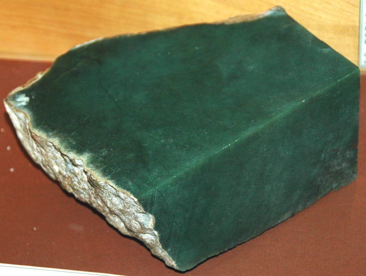 Top pick
Seminoe Reservoir
PublicCarbon County, Wyoming
Seminoe Reservoir represents the Seminoe Mountains side of Wyoming's jade and lapidary-rock story, with WSGS noting silicified banded iron formation from the Seminoe Mountains alongside the state's better-known jade resources. It earns a top-10 place because it broadens the Wyoming set into Carbon County while staying tied to a distinctive hard, polishable material.
Jade
 Top pick
Hartville
PublicPlatte County, Wyoming
Hartville is the southeastern Wyoming choice for Guernsey Limestone chalcedony, including moss agate, dendritic agate, stalactitic agate, and youngite noted by WSGS. Its appeal is the combination of lapidary-grade silica and mining-district geology in a part of the state outside the central Sweetwater jade and agate belt.
Agate, Moss Agate, Chalcedony
 Top pick
Frisco
PublicBeaver County, Utah
Frisco combines a major historic silver-lead camp with a long mineral list that includes copper carbonates, galena, sphalerite, pyrite, opal, and wulfenite. Mindat documents the San Francisco district's specimen minerals, while USGS mapping and Utah history sources place the locality in one of Beaver County's most important mining landscapes.
Azurite, Barite, Calamine, Chalcocite
 Top pick
San Rafael Swell
PublicEmery County, Utah
The San Rafael Swell is a broad exposed anticline where Morrison, Curtis, and Cedar Mountain strata carry local agate, jasper, chalcedony, petrified wood, and dinosaur-bone material. BLM manages the Swell as a major public recreation area, and UGS describes the same formations as part of the area's collectible rock and mineral resource base.
Agatized Wood, Amethyst, Carnotite, Petrified Wood
 Top pick
Dugway Range
PublicJuab County, Utah
The Dugway Geode Beds are one of Utah's clearest geology-to-specimen localities: Miocene rhyolite cavities were eroded by Lake Bonneville and redeposited as diggable geodes in lake sediments. BLM lists the beds as a rockhounding hotspot, and UGS notes that the geodes commonly contain clear, purple, or pink quartz.
Beryl, Chalcedony, Fluorite, Garnet
 Top pick
Spor Mountain
PublicJuab County, Utah
Spor Mountain stands out because its topaz-rhyolite-related deposits made it the world's premier beryllium district and Utah's largest fluorite producer. Mindat documents bertrandite, fluorite, chalcedony, opal, carnotite, hematite, magnetite, pyrite, quartz, and topaz across the district, which makes it more than a single-specimen stop.
Fluorite, Bertrandite, Carnotite, Chalcedony
 Top pick
Topaz Dome Quarry
PublicJuab County, Utah
Topaz Mountain is Utah's defining gem locality, where amber topaz crystals formed in cavities of the Topaz Mountain Rhyolite and commonly bleach colorless in sunlight. The BLM identifies the area as a public rockhound recreation site, while the Utah Geological Survey documents topaz, red beryl, amethyst, garnet, bixbyite, opal, and hematite in the same volcanic field.
Beryl, Calcite, Bixbyite, Carnelian
 Top pick
Black Rock
PublicMillard County, Utah
Black Rock is Utah's standout obsidian stop, with black, reddish-brown, and snowflake obsidian weathering from young rhyolitic volcanic rocks in the Black Rock Desert. UGS places the Black Spring collecting area on BLM public land and ties the glass to eruptions that also produced rhyolite and pumice in western Millard County.
Snowflake Obsidian
 Top pick
Marysville
PublicPiute County, Utah
Marysvale earns a top spot for small but well-formed crystals in rhyolite cavities, especially bixbyite, amethyst, and reported rutile or pseudobrookite. UGS describes the occurrence as BLM public land in a mid-Tertiary volcanic field, and Mindat records the same locality north of Marysvale with bixbyite, amethyst, pseudobrookite, and rutile.
Cinnabar, Alunite, Albite, Biotite
 Top pick
Gold Hill
PublicTooele County, Utah
Gold Hill is one of Utah's most mineralogically varied old districts, with arsenic, gold, copper, lead, silver, tungsten, and zinc production tied to skarn, vein, and replacement deposits. UGS identifies it as Utah's leading historical producer of tungsten and arsenic, and Mindat records a broad suite of collectible secondary copper, lead, and zinc minerals around the district.
Azurite, Cerussite, Chalcopyrite, Chlorite
 Top pick
Great Salt Lake
PublicTooele County, Utah
The Tooele side of Great Salt Lake offers an unusual sediment specimen rather than a hard-rock target: oolitic sand made of calcium-carbonate coats around tiny nuclei in shallow, wave-agitated brine. UGS documents accessible oolitic dunes on BLM public lands at Stansbury Island and explains that Great Salt Lake sand is often chemically grown in the lake rather than washed down as quartz grains.
Aragonite, Bloedite, Gypsum, Halite
 Top pick
Hanksville
PublicWayne County, Utah
The Hanksville and Caineville stretch of Wayne County is a strong public-land agate and petrified-wood area because weathering has released chalcedony, chert, jasper, and silicified wood from Mesozoic sedimentary rocks. UGS describes BLM public land where specimens can be found close to the road, while Utah collecting rules make clear that petrified wood has personal-use limits and protected park or private lands must be avoided.
Agate, Jasper, Petrified Wood
 Top pick
Mineral Wells Fossil Park
PublicPalo Pinto County, Texas
Mineral Wells Fossil Park exposes Pennsylvanian marine shale roughly 300 million years old, where eroded slopes yield abundant crinoid stems, brachiopods, sea urchins, and bivalves. The City of Mineral Wells runs the site as a free public park, and visitors may keep what they find for personal use. It is one of the most accessible fossil-collecting sites in North Texas.
Crinoid Stems, Brachiopods, Echinoids, Bivalves
 Top pick
Ladonia Fossil Park
PublicFannin County, Texas
The North Sulphur River channel at Ladonia cuts into Late Cretaceous marine beds that yield shark teeth, mosasaur teeth and bone, ammonites, and Exogyra oysters. The Upper Trinity Regional Water District operates the site as a free public fossil park, and what visitors find is theirs to keep. Mosasaur material is among the more common vertebrate finds.
Fossilized Shark Teeth, Ammonites, Mosasaur Teeth, Fossilized Oysters
 Top pick
Whiskey Bridge (Brazos River)
PublicBurleson County, Texas
Whiskey Bridge exposes the Stone City beds of the Eocene Crockett Formation, widely regarded as the most fossiliferous marine outcrop in Texas, with well over 200 identified species. Collectors routinely recover Eocene snails such as Turritella, clams, small corals, and tusk shells from the bluff below the State Highway 21 bridge. The Brazos River bed here is state-owned navigable land open to the public.
Fossil Snails, Fossilized Shells, Coral, Scaphopods
 Top pick
Brazos River at Brazos Park East
PublicMcLennan County, Texas
The Brazos is a navigable Texas river, so its bed is state-owned and open to public use where reached from a public access point. Brazos Park East in Waco provides a free city boat ramp onto that bed, where exposed gravel bars carry petrified wood, agatized wood, agate, and chert washed down from upstream formations. Low water exposes the best gravel.
Petrified Wood, Agatized Wood, Agate, Jasper
 Top pick
Llano River at Grenwelge Park
PublicLlano County, Texas
The Llano River cuts through the Precambrian Llano Uplift, so its gravels carry granite, gneiss, schist, garnet, and quartz, including the blue quartz that defines local llanite. Grenwelge Park gives free public access to the south bank of this navigable river in the town of Llano. Several other free city parks nearby also reach the river.
Blue Quartz, Quartz, Almandine Garnet, Granite
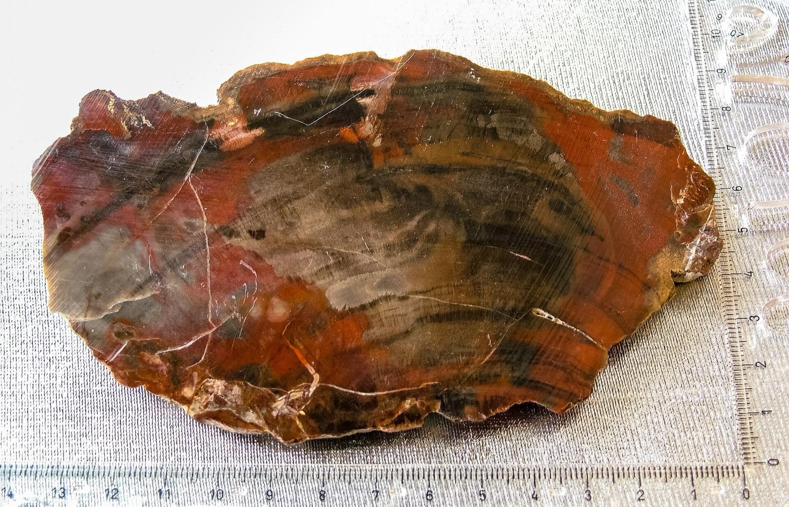 Top pick
Davy Crockett National Forest (Ratcliff Lake)
PublicHouston County, Texas
The Davy Crockett National Forest sits in the petrified-wood belt of East Texas, where silicified and agatized wood weathers out of Catahoula and Manning Formation gravels alongside jasper and agate. The US Forest Service issues free use permits for personal collection of petrified wood and common lapidary minerals on the forest. Vertebrate fossils and artifacts remain off limits.
Petrified Wood, Agatized Wood, Jasper, Agate
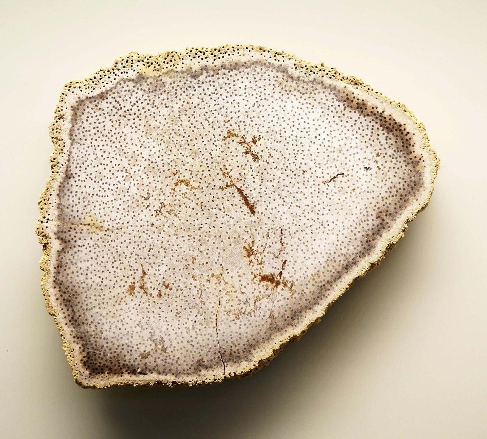 Top pick
Sam Houston National Forest (Double Lake)
PublicSan Jacinto County, Texas
Sam Houston National Forest carries petrified palm wood, the official Texas state stone since 1969, along with agate, jasper, and chalcedony weathered from young Gulf Coastal Plain gravels. The US Forest Service permits personal collection of common lapidary minerals and petrified wood here under a free use permit. Vertebrate fossils and artifacts are excluded.
Petrified Palm Wood, Petrified Wood, Agate, Jasper
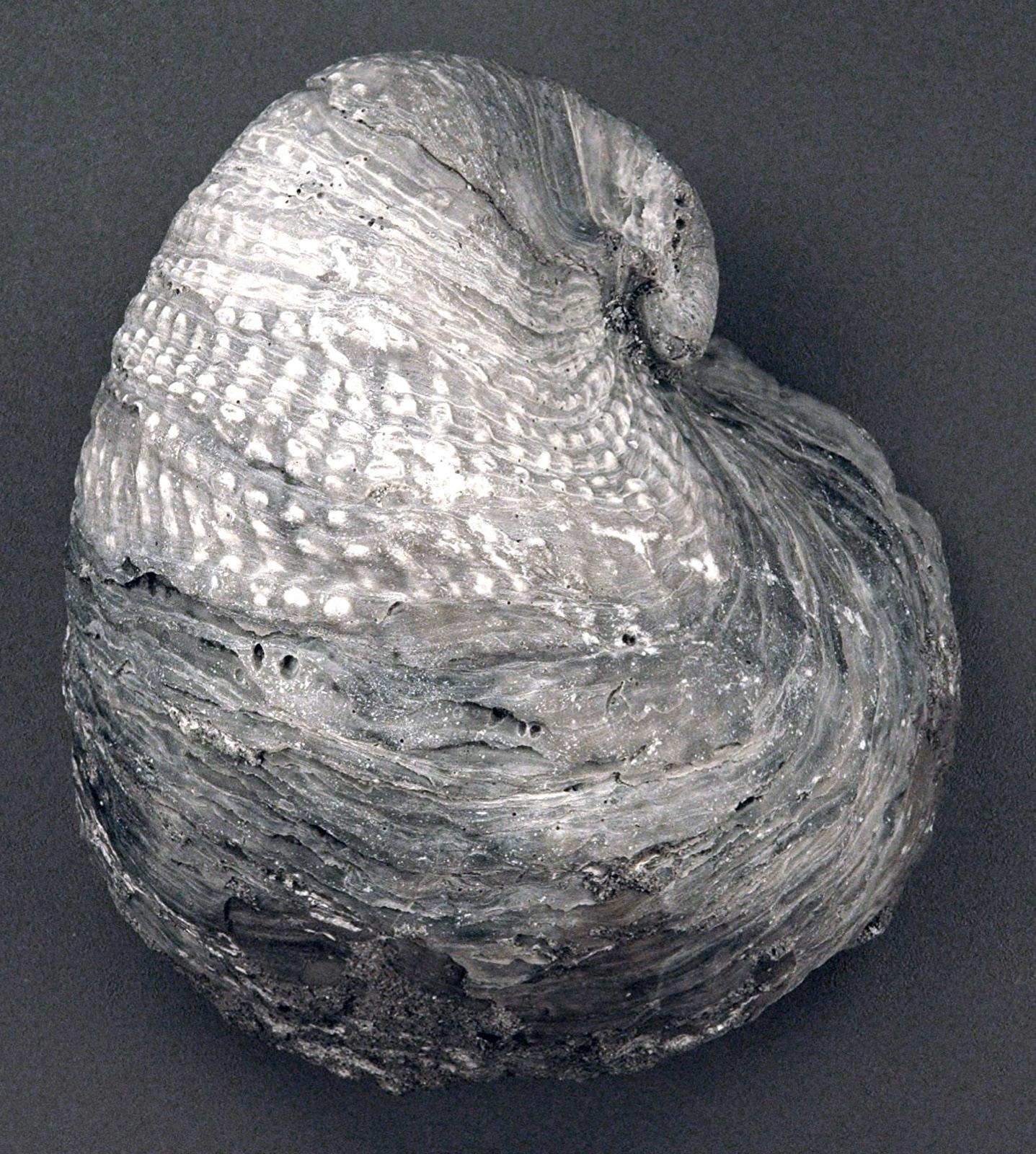 Top pick
Lyndon B. Johnson National Grassland (Black Creek Lake)
PublicWise County, Texas
The Lyndon B. Johnson National Grassland exposes Cretaceous limestone full of fossil oysters along its ridges, plus agate, chert, and petrified wood in its sandy soils. The US Forest Service allows personal collection of common minerals, petrified wood, and invertebrate fossils here under a free use permit. Vertebrate fossils and artifacts are prohibited.
Fossilized Oysters, Agate, Petrified Wood, Chert
 Top pick
Devils Head (Rampart Range)
PublicDouglas County, Colorado
Devils Head sits in the Pikes Peak granite of the Rampart Range, where weathered pegmatite pockets have produced large topaz and smoky quartz crystals along with amazonite and fluorite. The locality lies on Pike National Forest land, and personal-use specimen collecting with hand tools is allowed on open ground. It is one of the classic crystal-pocket areas of the Front Range.
Smoky Quartz, Topaz, Amazonite, Fluorite
 Top pick
St. Peters Dome (Gold Camp Road)
PublicEl Paso County, Colorado
St. Peters Dome is a Pikes Peak granite peak in Pike National Forest where the historic Cheyenne fluorspar district left dumps that still yield loose purple, green, and white fluorite within a short walk of the parking area. Smoky quartz, amazonite, zircon, and topaz occur in the same granite. The collecting ground sits south of the Bear Creek watershed closure, so it remains open to casual hand-tool collecting.
Fluorite, Smoky Quartz, Amazonite, Zircon
 Top pick
Tarryall Mountains (Spruce Grove)
PublicPark County, Colorado
The Tarryall Mountains are one of the better topaz localities in the Pikes Peak region, with smoky quartz and pale amazonite in pegmatites of the Redskin Stock. Trails from Spruce Grove Campground on Pike National Forest lead to mine tailings where collectors have found smoky topaz. Personal-use collecting with hand tools is allowed on the surrounding open Forest Service ground.
Smoky Quartz, Topaz, Amazonite
 Top pick
Del Norte Thunder Egg Beds
PublicSaguache County, Colorado
The thunderegg beds northwest of Del Norte have yielded plume and moss agate from rhyolite flows since the late 1800s, with chalcedony, common opal, and quartz-lined cavities documented at the locality. The beds lie on Rio Grande National Forest and adjacent BLM land at the south end of the La Garita Mountains. Plume agate is the signature material.
Plume Agate, Moss Agate, Chalcedony, Common Opal
 Top pick
Crystal Hill
PublicSaguache County, Colorado
Crystal Hill near La Garita is documented by the USGS as a source of clear rock crystal and pale lavender amethyst in brecciated volcanic rock, a San Luis Valley collecting site worked since the 1880s. The BLM reclaimed the old mine workings around 2009 and allows public collecting on the reclaimed ground. Smoky quartz and manganese oxides occur in the same host.
Amethyst, Quartz, Smoky Quartz
 Top pick
Woodland Park Beach, Grand Marais
PublicAlger County, Michigan
Grand Marais is the most famous place in Michigan to hunt Yooperlites, sodalite-bearing syenite stones that glow bright orange under ultraviolet light. Woodland Park provides free public Lake Superior beach to search after dark, where the shoreline below the high-water mark is public land. Lake Superior agates and jasper turn up in the same gravel by day.
Yooperlite, Lake Superior Agate, Jasper
 Top pick
Drummond Island (Pudding Stone)
PublicChippewa County, Michigan
Drummond Island is one of the best places in Michigan to find pudding stone, a striking metaconglomerate of red jasper pebbles set in white quartzite that glaciers carried south from Ontario. The Township Park puts a free public Lake Huron beach and boat launch within five miles of the ferry. The shoreline below the high-water mark is public land open to collectors.
Pudding Stone, Jasper Conglomerate, Petoskey Stones
 Top pick
Harvard Quarry (Noyes Mountain)
PublicOxford County, Maine
The historic Harvard Quarry on Noyes Mountain produced the gem green tourmaline that gave the Harvard green color its name, and its dumps still yield schorl, beryl, smoky quartz, rose quartz, and purple apatite. The quarry acre is held open to the public by its private owner at no charge, and the surrounding Noyes Mountain Preserve permits rock hounding under the Western Foothills Land Trust.
Green Tourmaline, Schorl, Beryl, Rose Quartz
 Top pick
Sandy River at New Sharon
PublicFranklin County, Maine
The Maine Geological Survey lists the Sandy River from Avon to New Sharon as open to recreational gold prospecting, one of the few reaches where even motorized methods are allowed. The gold is fine placer flour gold carried in the river's black sand, with garnet and magnetite among the heavy concentrates. The state maintains a free public boat access on the river off Route 2.
Gold, Garnet, Magnetite
 Top pick
St. Croix River at Grand Falls Flowage
PublicWashington County, Maine
The Maine Geological Survey lists the St. Croix River at Baileyville among the state's recreational gold-panning streams, where the gold is very fine flour gold thought to be shed from nearby base-metal mineralization. A state-owned boat access on the Grand Falls Flowage gives free public entry to the water. Garnet and magnetite occur in the same black sand.
Gold, Garnet, Magnetite
 Top pick
Tunk Mountain
PublicHancock County, Maine
Tunk Mountain is carved from the Tunk Lake pluton, a concentrically zoned alkali granite that grades into rapakivi granite, producing smoky quartz, perthitic feldspar, and dark hornblende-bearing rock. The peak sits on Donnell Pond Public Reserved Land, where the Maine Geological Survey allows casual hobby collecting without a permit. It is a granite-and-quartz site rather than a gem pegmatite.
Smoky Quartz, Feldspar, Hornblende, Biotite
 Top pick
Quartzville Recreational Mining Corridor
PublicLinn County, Oregon
Quartzville Creek runs through a designated recreational mining corridor on BLM public land east of Sweet Home, where a stretch of the Wild and Scenic River is withdrawn from mineral entry but left open to casual prospecting. Panners recover fine placer gold and occasional small flakes from the creek gravels, which also carry quartz, agate, and jasper eroded from the surrounding volcanic rocks. The corridor sits below the historic Quartzville Mining District, the lode source for the area's gold.
Gold, Agate, Jasper, Quartz
 Top pick
Hampton Butte
PublicDeschutes County, Oregon
Hampton Butte, north of Brothers in central Oregon, is the classic source of green petrified wood, where Eocene wood was replaced by jasper and chalcedony and tinted by copper and iron minerals. Collecting on the surrounding BLM public land turns up petrified wood, limb casts, agate, and jasper, with the prized pieces ranging from turquoise to dark green. Mindat catalogs the locality in Deschutes County, and the wood has been documented in scientific studies of Oregon's fossil forests.
Petrified Wood, Jasper, Agate
Rockhounding map FAQ
- How many rockhounding spots are on the map?
- The map plots 2,800+ rockhounding spots across the United States and Canada. Each pin carries coordinates, the minerals reported there, and a land-access label so you can plan a trip before you drive out.
- Can I filter the map by country, mineral, or region?
- Yes. Filter the map by country (United States or Canada), by mineral (agate, quartz, geodes, petrified wood, and more), by state or province, and by land access so you only see the spots that match the trip you are planning.
- What do the land-access labels mean?
- Public means open collecting on public land, though you should still confirm local rules. Paid / fee marks fee-dig and pay-to-prospect sites. Permission means private or restricted ground where you need to ask the owner or managing agency first. On the map, public spots show green and every restricted spot shows red, so you can read access at a glance.
- Are the rockhounding spots free to visit?
- Many sit on public land and are free to collect on, while others are fee-dig sites or need permission. Use the access filter to show only the public spots if you are after free collecting.
- How do I get coordinates and directions for a spot?
- Tap any pin to open its full spot page with exact coordinates, the minerals found there, and access notes. The RockHoundR app adds turn-by-turn directions, public land overlays, weather, and offline maps.
- Where can I browse spots for one state or mineral?
- Open the spots-by-state index to see every mapped spot in a single state, or the find pages to see the best states for a specific rock or mineral with identification tips.
Plan your next field day in the app
The RockHoundR app turns this map into a real planning tool: BLM, USFS, NPS, and tribal land overlays, weather, geology, and your saved finds.
