
Hillsboro: Blue Silicified Coral Rockhounding in Pocahontas County, West Virginia
- Mineral reported
- 1
- Elevation
- 2,100 ft
- Best months
- March to November
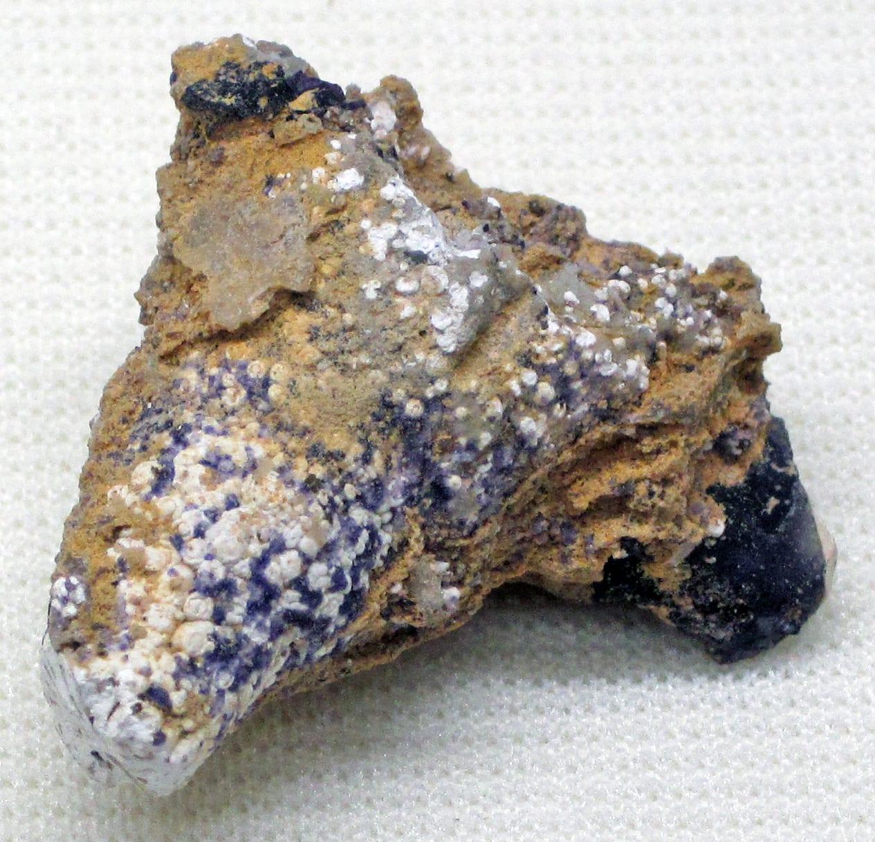
The Hillsboro area produces West Virginia's official state gem: the Mississippian colonial coral Lithostrotionella, silicified and replaced by chalcedony in the Hillsdale Limestone. Pocahontas County coral occurs in gray, pink, red, and the prized deep blue, and the blue chalcedony coral from around Hillsboro is the material most often cut and polished as the state gemstone. Weathered from the limestone into local soils and creek gravels, it is one of the most distinctive lapidary stones in the Appalachians. Reported finds include blue silicified coral. Below: coordinates, access notes, nearby spots, and trip-planning links.
Plan your visit
Generally open to casual rockhounding
- County
- Pocahontas County
- State
- West Virginia
- Nearest road
- Locust Creek Road
- Postcode
- 24946
- Coordinates
- 38.09252, -80.25087
Coordinates are approximate. Confirm the exact ground in the RockHoundR app, where land overlays show which agency manages the area.
Land & collecting status
Generally open to casual rockhounding
Most public-tagged spots sit on BLM, U.S. Forest Service, or other federal land where reasonable hand collecting of common rocks and minerals is allowed. Confirm posted rules and active mining claims before you dig.
Access note: The coral weathers out as float in fields and creek gravels around Hillsboro, and most of that ground is private farmland: get the landowner's permission before collecting, and stay out of Droop Mountain Battlefield State Park and other state parks nearby, where all collecting is prohibited. The same coral washes into public creek and river gravels, which can be surface-collected below the high-water mark from public access points.
Public-land rules vary by agency, season, and field office. The RockHoundR app pulls live BLM, USFS, NPS, and tribal overlays so you can see exactly which agency manages the ground at this spot.
Best time to visit Hillsboro
Comfortable months (45 to 90°F highs)
Best months: March to November. Typical highs run 82°F in midsummer and 38°F in midwinter, with winter lows near 19°F.
Climate normals: NOAA 1991-2020 monthlies, BUCKEYE station (9 mi away).
Geology at Hillsboro
This spot sits on Maccrady Formation, mapped as sandstone and shale that formed roughly 360 to 325 million years ago. Sedimentary layers like these are where fossils are typically preserved, and fresh exposures after rain or in active cuts tend to produce best.
- Mapped unit
- Maccrady Formation
- Age
- 360–325 Ma (Mississippian)
- Rock types
- sandstone and shale
- Elevation
- 2,100 ft
Geologic mapping via Macrostrat and the underlying state geological survey maps (CC BY 4.0). Bedrock at the surface can vary within a mapped unit.
Today's weather
Is today a good day to go?
The app shows live weather, recent rain, and a daily rockhounding score for Hillsboro.
Get the appSources & verification
Spot details combine the public RockHoundR location dataset, normalized mineral labels, agency land-status checks in the app, and community submissions. Coordinates are approximate until verified in the field.
- West Virginia Geological and Economic Survey
- Monongahela National Forest
- West Virginia State Parks rules
- Community submissions reviewed against published agency rules
Found at Hillsboro
Each name opens all spots that produce that material; the encyclopedia link opens the full ID and field guide.
Nearby rockhounding spots
Other rockhounding spots within driving distance of Hillsboro.
- Mill PointPocahontas County, West Virginia · 6 mi awayRed Silicified Coral
- RenickGreenbrier County, West Virginia · 8 mi awayCalcite, Fluorite
- HuntersvillePocahontas County, West Virginia · 15 mi awayChert Nodule
- WilliamsburgGreenbrier County, West Virginia · 16 mi awaySilicified Coral, Quartz
- Cranberry RiverWebster County, West Virginia · 21 mi awayQuartz Geode, Siderite, Nodule
- Knapp CreekPocahontas County, West Virginia · 22 mi awayGeode
- LewisburgGreenbrier County, West Virginia · 23 mi awaySmoky Quartz
- Sitlington CreekPocahontas County, West Virginia · 26 mi awayGeode
Across the state line from Hillsboro
Hillsboro is close enough to the West Virginia border that the next-closest rockhounding spots are in a neighboring state. Worth knowing if you are already on the road.
- Chestnut RidgeBath County, Virginia · 40 mi awayQuartz
- LexingtonRockbridge County, Virginia · 50 mi awayCalcite, Chalcopyrite, Dolomite
- SpottswoodRockbridge County, Virginia · 54 mi awayQuartz
- Peaks of OtterBedford County, Virginia · 58 mi awayBeryl, Columbite, Feldspar
- SalemRoanoke County, Virginia · 58 mi awayAgate
- Big Mary's CreekRockbridge County, Virginia · 59 mi awayUnakite
Hillsboro FAQ
Where is Hillsboro?+
What rocks and minerals can you find at Hillsboro?+
Is collecting allowed at Hillsboro?+
What tools should I bring to Hillsboro?+
When is the best time to visit Hillsboro?+
How do I get to Hillsboro?+
More rockhounding in West Virginia
See all 41 West Virginia spots →
Open Hillsboro on the map
Use the RockHoundR app for live land overlays, weather, geology, directions, and saved finds.


