
Where to Find Fossils in Wisconsin
Wisconsin has 5 mapped collecting spots that report fossils, spread across 5 counties. 4 of the spots are on land mapped as publicly accessible.
Every fossil spot we track in Wisconsin
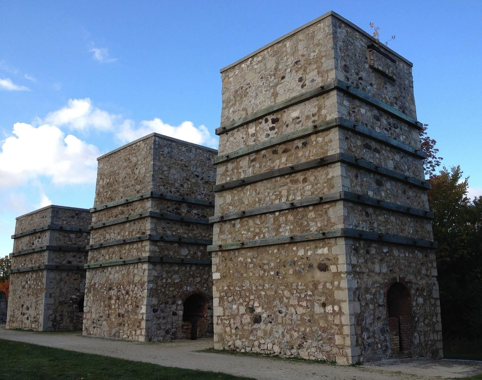 Best spotLime Kiln ParkOzaukee County, WisconsinPublic access · Fossil, Coral, Crinoid +1
 Best spotRacineRacine County, WisconsinPublic access · Fossil, Calcite, Marcasite
 OshkoshWaushara County, WisconsinPublic access · Calcite, Galena, Marcasite +3
- Red Arrow BeachManitowoc County, WisconsinPublic access · Honeycomb Coral, Favosites, Chain Coral +3
 Bluffs of Miss. RiverLa Crosse County, WisconsinPermission required · Lake Superior Agate, Jasper, Diamond +1
Standout fossil spots in Wisconsin
Hand-picked from the full list above, with the reason each one earns a trip.
Lime Kiln Park
Ozaukee County
Lime Kiln Park near Grafton preserves two small Silurian reefs in the walls of a former limestone quarry along the Milwaukee River.
Racine
Racine County
Quarry Lake Park in Racine exposes the Silurian Racine Formation dolomite, part of the reef complex recognized as among the first fossil coral reefs described in North America.
Best counties for fossils in Wisconsin
Ranked by the number of mapped fossil spots. County links open the full rockhounding page for that county.
- La Crosse County1 spot
- Manitowoc County1 spot
- Ozaukee County1 spot
- Racine County1 spot
- Waushara County1 spot
Fossils in Wisconsin FAQ
Where can you find fossils in Wisconsin?+
How many fossil spots are mapped in Wisconsin?+
Is it legal to collect fossils in Wisconsin?+
Where else to find fossils
More minerals to hunt in Wisconsin
Hunt fossils in Wisconsin with the map in your pocket
RockHoundR puts these spots on an offline map with BLM and Forest Service overlays, geology layers, and a log for your finds.

