Gloss Mountain State Park: Selenite & Gypsum Rockhounding in Major County, Oklahoma
- Minerals reported
- 2
- Elevation
- 1,460 ft
- Best months
- September to June
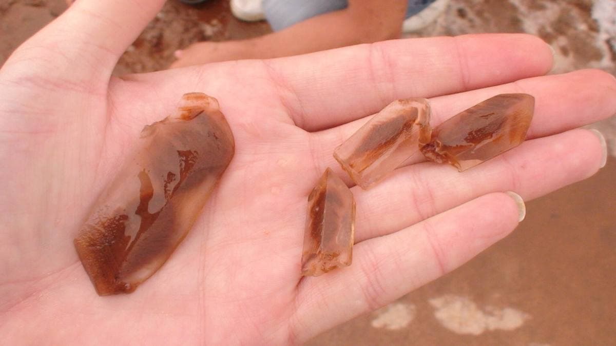
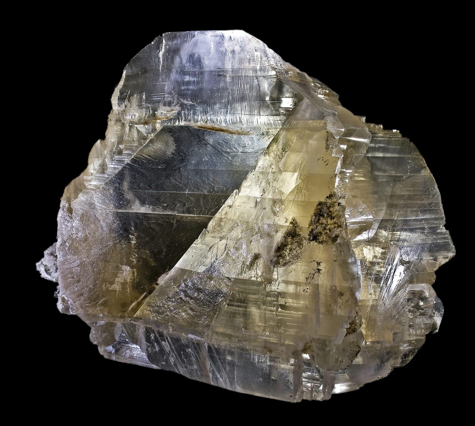
The Gloss Mountains, also spelled Glass Mountains, are flat-topped mesas capped by beds of selenite gypsum that catch the light and give the range its sparkle. Gloss Mountain State Park is one of the few Oklahoma parks that lets visitors take home loose selenite, and the park keeps baskets of surface crystals along the trail for that purpose. It is an easy, family-friendly place to collect the state crystal without digging. Reported finds include selenite, gypsum. Below: coordinates, access notes, nearby spots, and trip-planning links.
Plan your visit
Confirm rules before collecting
- County
- Major County
- State
- Oklahoma
- Nearest road
- US 412
- Postcode
- 73737
- Coordinates
- 36.36850, -98.57810
Coordinates are approximate. Confirm the exact ground in the RockHoundR app, where land overlays show which agency manages the area.
Land & collecting status
Confirm rules before collecting
Land status here is not confirmed. Verify with the managing agency before collecting, federal, state, and tribal rules differ.
Access note: Gloss Mountain State Park lets visitors take small loose selenite specimens found on the surface, but digging, excavation, and power tools are not allowed. Rules can change, so check with park staff at the trailhead. Stay on the marked trails on the mesa and do not pry crystals from the caprock.
Public-land rules vary by agency, season, and field office. The RockHoundR app pulls live BLM, USFS, NPS, and tribal overlays so you can see exactly which agency manages the ground at this spot.
Best time to visit Gloss Mountain State Park
Comfortable months (45 to 90°F highs)
Best months: September to June. Typical highs run 95°F in midsummer and 48°F in midwinter, with winter lows near 25°F. Summer heat here is intense, so carry more water than you think you need and work the early morning.
Climate normals: NOAA 1991-2020 monthlies, FAIRVIEW 5NW MESONET station (4 mi away).
Geology at Gloss Mountain State Park
This spot sits on Blaine Formation, mapped as gypsum, dolostone, and shale that formed roughly 300 to 250 million years ago. Carbonate rock like this dissolves and weathers readily, so fresh road cuts, quarries, and creek exposures are typically the most productive ground.
- Mapped unit
- Blaine Formation
- Age
- 300–250 Ma (Permian)
- Rock types
- gypsum, dolostone, and shale
- Elevation
- 1,460 ft
Geologic mapping via Macrostrat and the underlying state geological survey maps (CC BY 4.0). Bedrock at the surface can vary within a mapped unit.
Today's weather
Is today a good day to go?
The app shows live weather, recent rain, and a daily rockhounding score for Gloss Mountain State Park.
Get the appSources & verification
Spot details combine the public RockHoundR location dataset, normalized mineral labels, agency land-status checks in the app, and community submissions. Coordinates are approximate until verified in the field.
- Salt Plains National Wildlife Refuge, selenite digging
- Oklahoma Geological Survey
- Ouachita National Forest
- Community submissions reviewed against published agency rules
Found at Gloss Mountain State Park
Each name opens all spots that produce that material; the encyclopedia link opens the full ID and field guide.
Nearby rockhounding spots
Other rockhounding spots within driving distance of Gloss Mountain State Park.
- SouthardBlaine County, Oklahoma · 23 mi awayPriceite, Proberite, Ulexite
- Seiling & TalogaDewey County, Oklahoma · 28 mi awayAgate, Jasper, Petrified Wood
- AlvaWoods County, Oklahoma · 29 mi awayBanded Agate, Moss Agate, Chalcedony
- Great Salt PlainsAlfalfa County, Oklahoma · 29 mi awaySelenite, Halite
- Blaine CountyBlaine County, Oklahoma · 34 mi awayPriceite, Proberite, Ulexite
- El RenoCanadian County, Oklahoma · 66 mi awayAgate, Jasper, Petrified Wood
- BuffaloHarper County, Oklahoma · 67 mi awayAgate, Chalcedony, Chert
- RosstonHarper County, Oklahoma · 81 mi awayAragonite
Across the state line from Gloss Mountain State Park
Gloss Mountain State Park is close enough to the Oklahoma border that the next-closest rockhounding spots are in a neighboring state. Worth knowing if you are already on the road.
- Medicine Lodge RiverBarber County, Kansas · 47 mi awayAgate, Jasper, Agatized Wood
- AetnaBarber County, Kansas · 53 mi awayAgate, Agatized Wood
- Medicine LodgeBarber County, Kansas · 54 mi awayPetrified Wood
- Sun CityBarber County, Kansas · 71 mi awayGypsum, Calcite
- WilmoreComanche County, Kansas · 75 mi awayVolcanic Ash
- Chikaskia RiverKingman County, Kansas · 79 mi awayAgate, Jasper, Petrified Wood
Gloss Mountain State Park FAQ
Where is Gloss Mountain State Park?+
What rocks and minerals can you find at Gloss Mountain State Park?+
Is collecting allowed at Gloss Mountain State Park?+
What tools should I bring to Gloss Mountain State Park?+
When is the best time to visit Gloss Mountain State Park?+
How do I get to Gloss Mountain State Park?+
More rockhounding in Oklahoma
See all 36 Oklahoma spots →
Open Gloss Mountain State Park on the map
Use the RockHoundR app for live land overlays, weather, geology, directions, and saved finds.